
Image: Forts at Forks of Ohio
No higher resolution available.
Forts_at_Forks_of_Ohio.png (621 × 409 pixels, file size: 66 KB, MIME type: image/png)
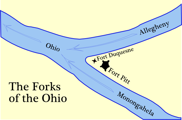
Description: The map places the forts according to the positions of reconstructed elements, such as this bastion of Ft. Duquesne. Self-made map of the Forks of the Ohio (Monongahela, Allegheny and Ohio rivers). Shows Fort Pitt and Fort Duquesne. Outlines of the walls (curtains) of the forts traced from the original plans as published in 19th century histories.
Title: Forts at Forks of Ohio
Credit: Own work
Author: en:User:Tomcool
Usage Terms: Creative Commons Attribution-Share Alike 3.0
License: CC BY-SA 3.0
License Link: http://creativecommons.org/licenses/by-sa/3.0
Attribution Required?: Yes
Image usage
The following 4 pages link to this image:

All content from Kiddle encyclopedia articles (including the article images and facts) can be freely used under Attribution-ShareAlike license, unless stated otherwise.