
Image: Four-shire-stone-map
Size of this preview: 674 × 600 pixels. Other resolutions: 270 × 240 pixels | 1,154 × 1,027 pixels.
Original image (1,154 × 1,027 pixels, file size: 2.53 MB, MIME type: image/png)
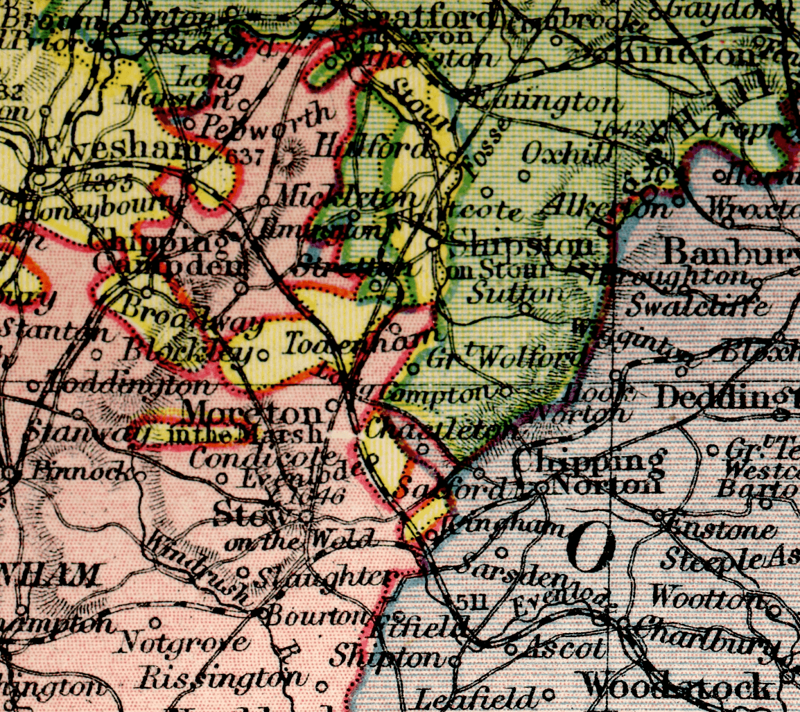
Description: A detail of plate 23/24 of Philips' New Handy General Atlas, 1921, showing four English counties meeting at the four-shire stone.
Title: Four-shire-stone-map
Credit: Own work
Author: George Philip (1800-1882) or his son George Philip (1823-1902). Derivative work: Maproom
Usage Terms: Public domain
License: Public domain
Attribution Required?: No
Image usage
The following page links to this image:

All content from Kiddle encyclopedia articles (including the article images and facts) can be freely used under Attribution-ShareAlike license, unless stated otherwise.