
Image: Fra Mauro World Map Satellite Comparison - Rotated

Size of this preview: 800 × 396 pixels. Other resolutions: 320 × 158 pixels | 1,978 × 979 pixels.
Original image (1,978 × 979 pixels, file size: 484 KB, MIME type: image/jpeg)
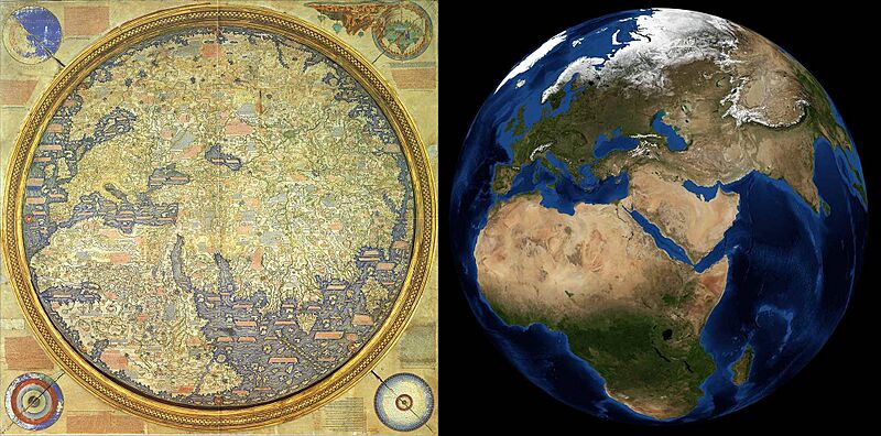
Description: A comparison of the Fra Mauro World Map from AD 1450 and a satellite image of Earth. The satellite image was created using data from the MODIS instrument onboard the Terra and Aqua satellites. This version of the image has been obtained from the NASA original by individually rotating both halves by 180°, to achieve the more familiar North-on-top orientation.
Usage Terms: Public domain
Image usage
The following page links to this image:

All content from Kiddle encyclopedia articles (including the article images and facts) can be freely used under Attribution-ShareAlike license, unless stated otherwise.