
Image: Ft-Heath-Map-1921
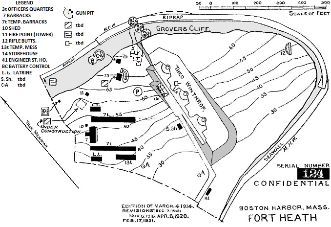
Description: This map, from the U.S. Army Engineers, is updated through 1921. The curving southwest boundary of the fort apparently followed the present course of Pond Street, Winthrop. The shorter leg running roughly northeast apparently followed Highland Avenue. All of the fort's structures and all traces of Battery Winthrop have apparently been demolished during the construction of Winthrop municipal park facilities and a very large apartment complex that appears to cover the former location of Battery Winthrop. A registration point for the 1921 map against current (2010) maps is provided by the indicated location of a 1934 survey marker GROVERS (MY0121) that used to exist on the roof of the southernmost of three now destroyed fire control buildings that once were located at the fort.
Title: Ft-Heath-Map-1921
Credit: U.S. Army Engineers Map
Usage Terms: Public domain
License: PD
Attribution Required?: No
Image usage
The following page links to this image:
