
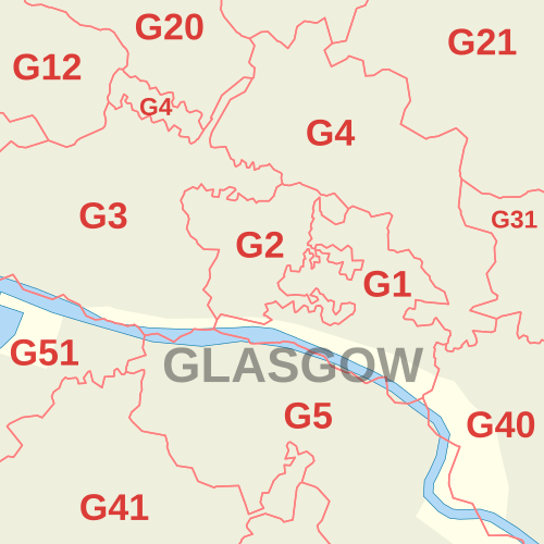
Image: G postcode area inset map

Description: Labelled Glasgow inset map of Royal Mail postcode districts of the G postcode area. Indicative postcode districts shown in red, post town shown in grey. Equirectangular projection with latitude stretching 180%, WGS84 datum. Geographic limits: Main 1:33,000 map: West: 4.295W East: 4.2248W North: 55.88N South: 55.841N
Title: G postcode area inset map
Credit: Derived from Ordnance Survey OS OpenData. Postcode district boundaries within Great Britain derived from Voronoi polygons of OS Code-Point Open unit postcode median coordinates (with coastline clipping and minor adjustments to avoid spurious detached polygons). Great Britain coastline, inland water and urban extent data derived from OS Strategi.
Author: Richardguk
Usage Terms: Creative Commons Attribution-Share Alike 3.0
License: CC BY-SA 3.0
License Link: https://creativecommons.org/licenses/by-sa/3.0
Attribution Required?: Yes
Image usage
The following page links to this image:
