
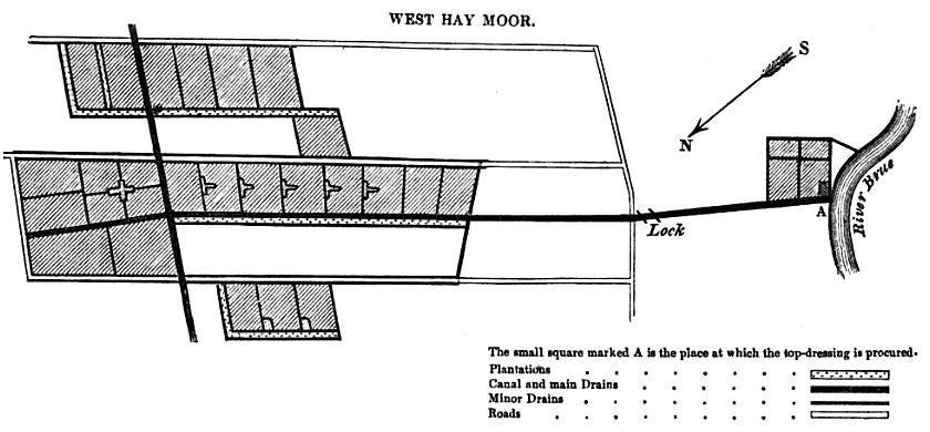
Image: Galtons Canal map
Size of this preview: 800 × 371 pixels. Other resolutions: 320 × 149 pixels | 840 × 390 pixels.
Original image (840 × 390 pixels, file size: 55 KB, MIME type: image/jpeg)
Description: Diagram of Galton's Canal, showing parts of Westhay Moor that were improved for agricultural purposes, from an article by Erasmus Galton published in 1845 in the Journal of the Royal Agricultural Society of England, Volume 6
Title: Galtons Canal map
Credit: Journal of the Royal Agricultural Society of England Vol 6 (1845)
Author: Erasmus Galton
Usage Terms: Public domain
License: Public domain
Attribution Required?: No
Image usage
The following page links to this image:

All content from Kiddle encyclopedia articles (including the article images and facts) can be freely used under Attribution-ShareAlike license, unless stated otherwise.