
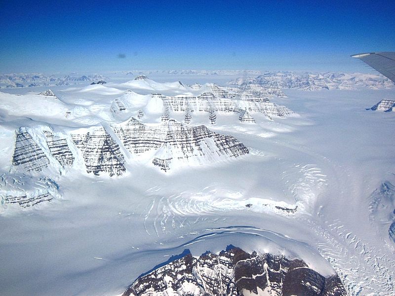
Image: Geikie Plateau Glacier

Size of this preview: 800 × 600 pixels. Other resolutions: 320 × 240 pixels | 1,024 × 768 pixels.
Original image (1,024 × 768 pixels, file size: 284 KB, MIME type: image/jpeg)
Description: Geikie Plateau glacier and mountain peaks in eastern Greenland seen from NASA's P-3B during an IceBridge survey flight on Apr. 11, 2013. The distinctive layering in the Geikie Plateau's mountains come from repeated flooding of basalt lava from the North Atlantic's mid-ocean ridge millions of years ago.
Title: Geikie Plateau Glacier
Credit: http://www.nasa.gov/mission_pages/icebridge/multimedia/spr13/DSCN3043.html
Author: NASA / Christy Hansen
Usage Terms: Public domain
License: Public domain
Attribution Required?: No
Image usage
The following page links to this image:

All content from Kiddle encyclopedia articles (including the article images and facts) can be freely used under Attribution-ShareAlike license, unless stated otherwise.