Image: Gem-Geldrop-Mierlo-OpenTopo

Size of this preview: 800 × 593 pixels. Other resolutions: 320 × 237 pixels | 4,233 × 3,140 pixels.
Original image (4,233 × 3,140 pixels, file size: 2.55 MB, MIME type: image/jpeg)
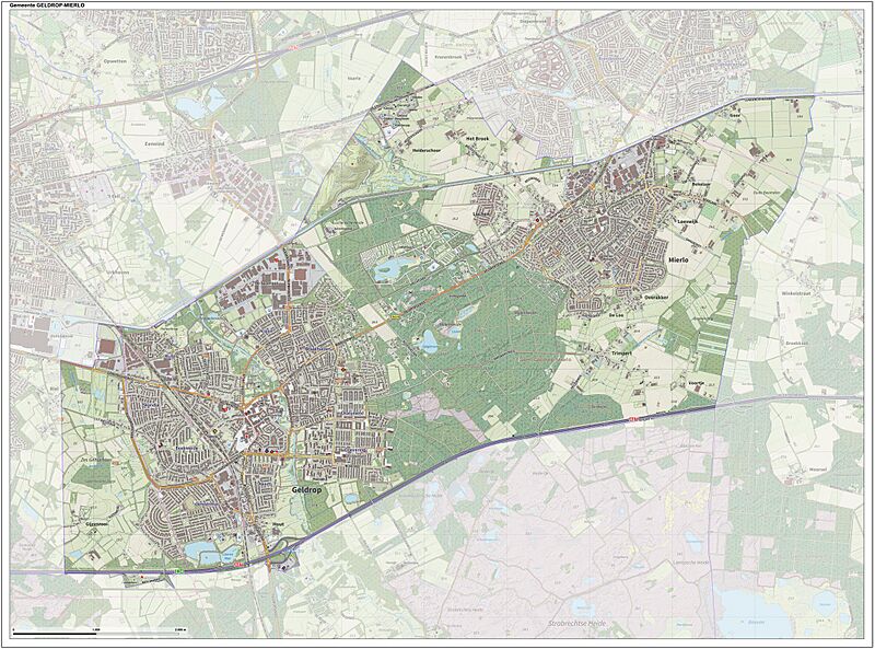
Description: Topografische gemeentekaart. Resolutie: 400 pixels/km. Kaartbeeld samengesteld uit de open geodata van de Top10NL en Top25namen, Kadaster, Creative Commons BY licentie. Gebouwvlakken uit open geodata BAG extract. Wegen uit de OpenStreetMap, OpenStreetMap community. Schaduwreliëf uit de Actuele Hoogtekaart AHN2. Samenstelling en kleurenschema: Jan-Willem van Aalst, met QGIS2. Zie ook de Legenda.
Title: Gem-Geldrop-Mierlo-OpenTopo
Credit: Own work
Author: Janwillemvanaalst
Usage Terms: Creative Commons Attribution-Share Alike 3.0
License: CC BY-SA 3.0
License Link: https://creativecommons.org/licenses/by-sa/3.0
Attribution Required?: Yes
Image usage
The following page links to this image:

All content from Kiddle encyclopedia articles (including the article images and facts) can be freely used under Attribution-ShareAlike license, unless stated otherwise.
