
Image: Geodispersal at Bering Land Bridge
Size of this preview: 449 × 600 pixels. Other resolutions: 180 × 240 pixels | 2,074 × 2,771 pixels.
Original image (2,074 × 2,771 pixels, file size: 415 KB, MIME type: image/png)
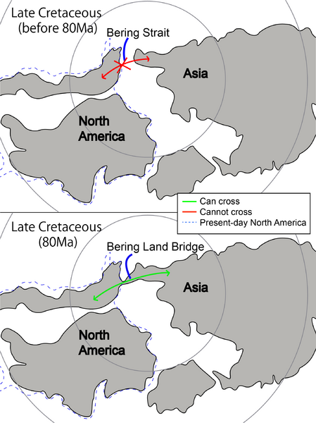
Description: The figure shows two maps viewed from the North Pole at early and mid-Late Cretaceous, which illustrates the formation of Bering Land Bridge between Asia and North America. The red line indicates that no faunal exchange occurred between the two land, while the green line suggests that faunal exchange was possible. The dotted line marks the boundary and shape of modern North America. Abbreviations: NA, North America; A, Asia; Ma, million years ago. Modified from Wen et al. (2016).
Author: JacqCLSin
Usage Terms: Creative Commons Attribution-Share Alike 3.0
License: CC-BY-SA-3.0
License Link: http://creativecommons.org/licenses/by-sa/3.0/
Attribution Required?: Yes
Image usage
The following page links to this image:

All content from Kiddle encyclopedia articles (including the article images and facts) can be freely used under Attribution-ShareAlike license, unless stated otherwise.