
Image: Germany and Poland borders during the 20th century Wlegend
Size of this preview: 421 × 599 pixels. Other resolutions: 169 × 240 pixels | 500 × 711 pixels.
Original image (500 × 711 pixels, file size: 32 KB, MIME type: image/png)
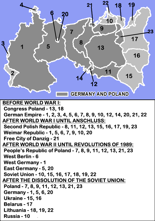
Description: Anachronical map pf Germany and Poland border changes during the 20th century.
Title: Germany and Poland borders during the 20th century Wlegend
Credit: The map uses the map and descriptions of en:File:Germany and Poland borders during the 20th century.gif created by User:MaGioZal, but adds a legend from the text contained in the description of that file.
Author: see source above and original upload log below
Usage Terms: Creative Commons Attribution-Share Alike 3.0
License: CC BY-SA 3.0
License Link: http://creativecommons.org/licenses/by-sa/3.0/
Attribution Required?: Yes
Image usage
The following 2 pages link to this image:

All content from Kiddle encyclopedia articles (including the article images and facts) can be freely used under Attribution-ShareAlike license, unless stated otherwise.