
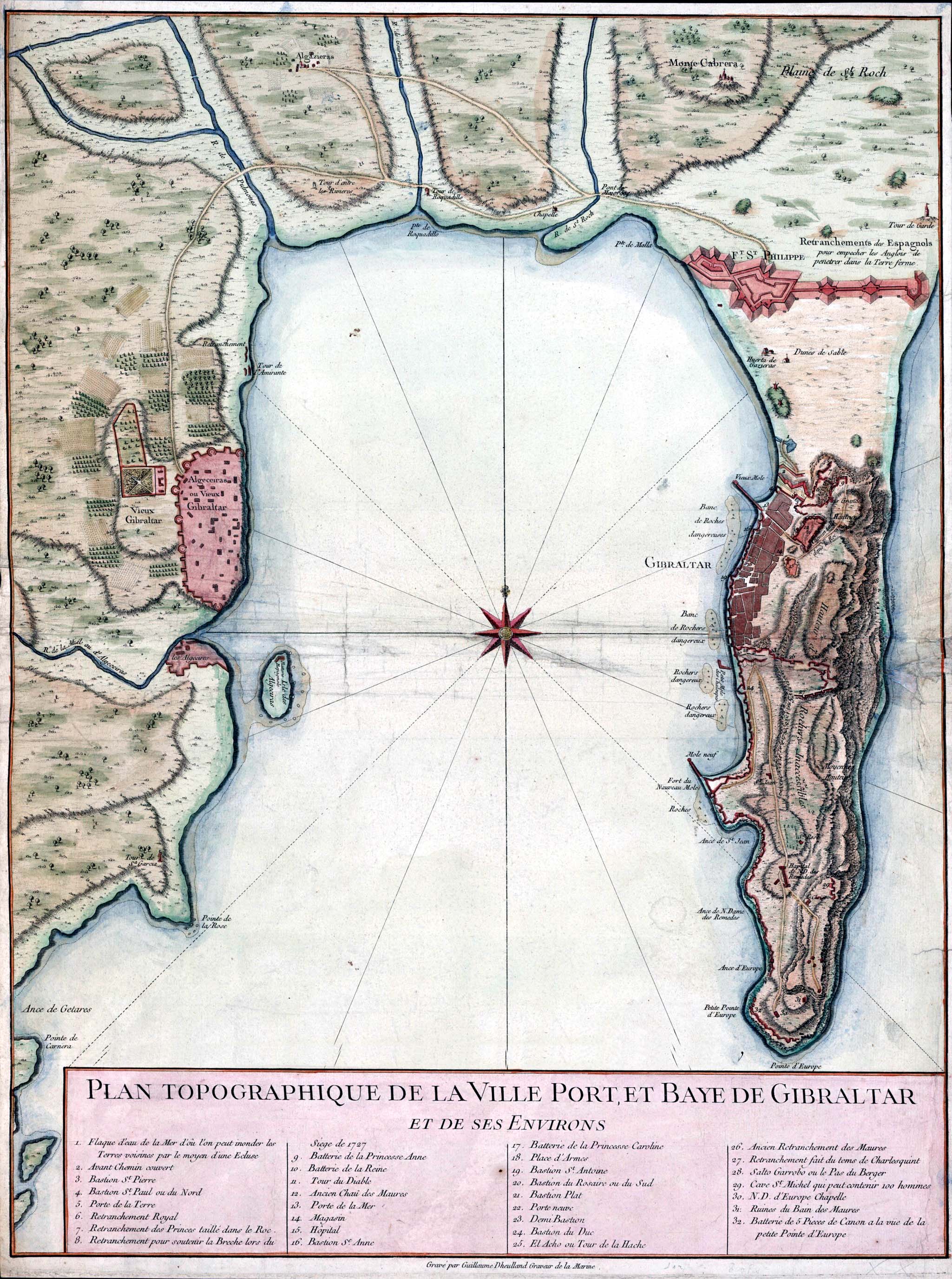
Image: Gibraltar and Bay map 1750
Size of this preview: 447 × 600 pixels. Other resolutions: 179 × 240 pixels | 2,049 × 2,750 pixels.
Original image (2,049 × 2,750 pixels, file size: 877 KB, MIME type: image/jpeg)
Description: Topographic map of Gibraltar and the Bay of Gibraltar, circa 1750
Title: Gibraltar and Bay map 1750
Credit: http://www.britishempire.co.uk/images3/gibraltar1750.jpg
Author: Guillaume Dheulland (1700–1770)
Usage Terms: Public domain
License: Public domain
Attribution Required?: No
Image usage
The following 4 pages link to this image:

All content from Kiddle encyclopedia articles (including the article images and facts) can be freely used under Attribution-ShareAlike license, unless stated otherwise.