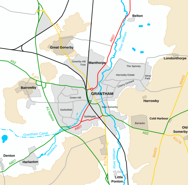
Image: Grantham relief map labelled

Description: A map showing the built-up area of Grantham in 2020, as well as surrounding settlements, roads and watercourses. The urban areas are shown in light grey. Land at or over 100m above sea level are shown shaded in beige. Key roads are shown as thick, coloured lines: primary routes in green, secondary routes in red, B roads in yellow and selected minor routes in mid-grey. Railway lines are shown as thick black lines. The watercourses are in blue; the canal is dashed and the section of the Mowbeck which is culverted is shown dotted. Settlement names are in bold; Grantham is capitalised and villages are not; suburban areas are presented in normal weight and smaller size. The map has been adapted from OpenStreetMap data, available under the Open Database Licence; the locations of Spittlegate and New Somerby are from the 1889-91 Ordnance Survey map.
Title: Grantham relief map labelled
Credit: https://www.openstreetmap.org/#map=13/53.1458/0.3157&layers=D
Author: Noswall59, OpenStreetMap contributors
Usage Terms: Creative Commons Attribution-Share Alike 4.0
License: CC BY-SA 4.0
License Link: https://creativecommons.org/licenses/by-sa/4.0
Attribution Required?: Yes
Image usage
The following page links to this image:

