
Image: Graphic map of the Dardanelles
Size of this preview: 800 × 554 pixels. Other resolutions: 320 × 222 pixels | 3,600 × 2,494 pixels.
Original image (3,600 × 2,494 pixels, file size: 1.18 MB, MIME type: image/jpeg)
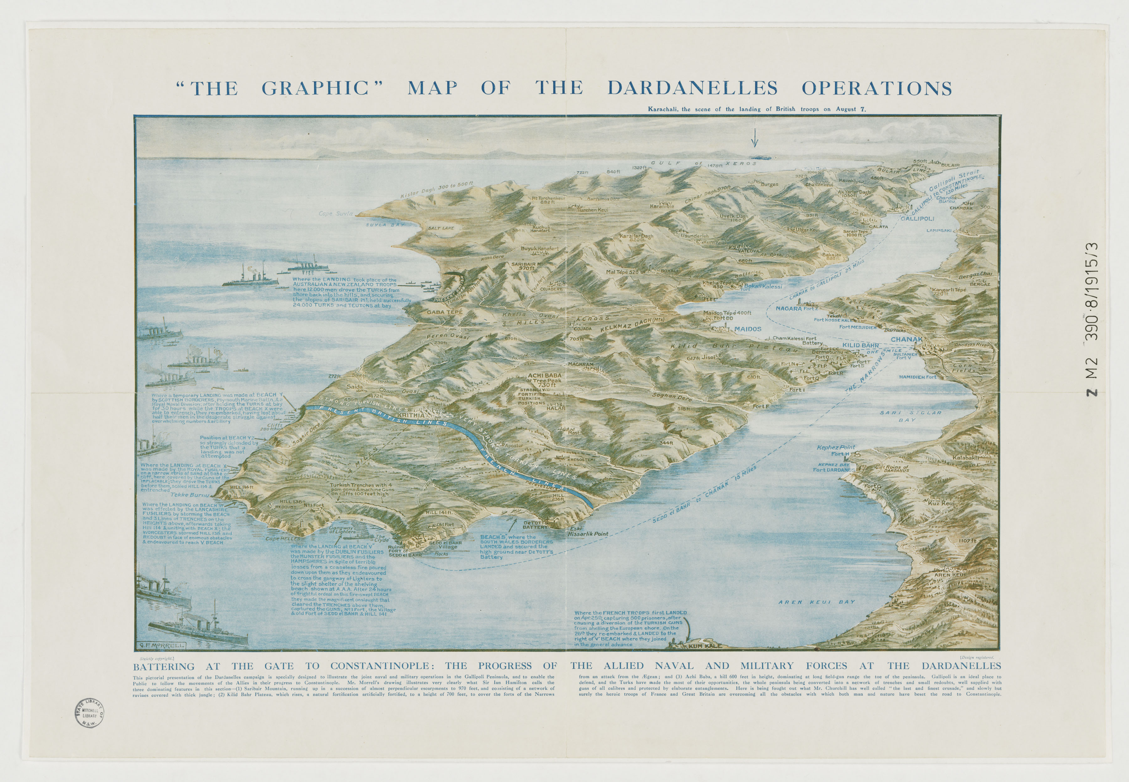
Description: Map of the Dardanelles drawn by G.F. Morrell, 1915. The map shows the Gallipoli peninsula and west coast of Turkey, and the location of front line troops and landings.
Title: Graphic map of the Dardanelles
Credit: http://library.sl.nsw.gov.au/record=b3001973~S2
Author: G.F. Morrell
Usage Terms: Public domain
License: Public domain
Attribution Required?: No
Image usage
The following page links to this image:

All content from Kiddle encyclopedia articles (including the article images and facts) can be freely used under Attribution-ShareAlike license, unless stated otherwise.