
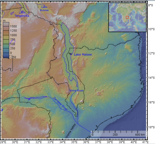
Image: Great Rift Valley southernmost section
Size of this preview: 646 × 600 pixels. Other resolutions: 259 × 240 pixels | 4,054 × 3,763 pixels.


Original image (4,054 × 3,763 pixels, file size: 7.95 MB, MIME type: image/png)
Description: Topographic map of the southernmost section of the Great Rift Valley, showing its course through Lake Malawi, the valley of the Shire River and the Urema Valley. Base map made with GeoMapApp software using the public domain Global Multi-Resolution Topography dataset
Author: Mikenorton
Usage Terms: Creative Commons Attribution-Share Alike 3.0
License: CC-BY-SA-3.0
License Link: http://creativecommons.org/licenses/by-sa/3.0/
Attribution Required?: Yes
Image usage
The following page links to this image:

All content from Kiddle encyclopedia articles (including the article images and facts) can be freely used under Attribution-ShareAlike license, unless stated otherwise.
