
Image: GreenvilleJC1872mapf
No higher resolution available.
GreenvilleJC1872map.tiff (455 × 502 pixels, file size: 546 KB, MIME type: image/tiff)
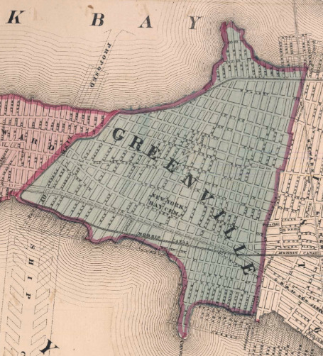
Description: Map of Greenville 1872 one year before the township voted to consolidate with Jersey City, becoming the southernmost section of the city bordering Bayonne. Newark Bay lies to the west (above) and Upper New York Bay lies to east (below). Subsequent reclamation in the 20th century increased the land area.
Title: GreenvilleJC1872map
Credit: http://mapmaker.rutgers.edu/1872Atlas/Bayonne_Greensville_1872.jpg Atlas of New Jersey FW Beers 1872
Author: Unknown
Usage Terms: Public domain
License: Public domain
Attribution Required?: No
Image usage
The following page links to this image:

All content from Kiddle encyclopedia articles (including the article images and facts) can be freely used under Attribution-ShareAlike license, unless stated otherwise.