
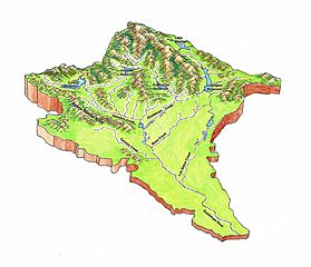
Image: Guadalupe River Watershed Topo Map

Size of this preview: 698 × 600 pixels. Other resolutions: 279 × 240 pixels | 2,174 × 1,868 pixels.
Original image (2,174 × 1,868 pixels, file size: 1.67 MB, MIME type: image/jpeg)
Description: From the 2005 Guadalupe River Watershed Mercury TMDL Project, modified from USGS Topo Map
Title: Guadalupe River Watershed Topo Map
Credit: Guadalupe River Watershed Mercury TMDL Project
Author: TetraTech Modified from USGS Topo Map
Usage Terms: Public domain
License: Public domain
Attribution Required?: No
Image usage
The following page links to this image:

All content from Kiddle encyclopedia articles (including the article images and facts) can be freely used under Attribution-ShareAlike license, unless stated otherwise.