
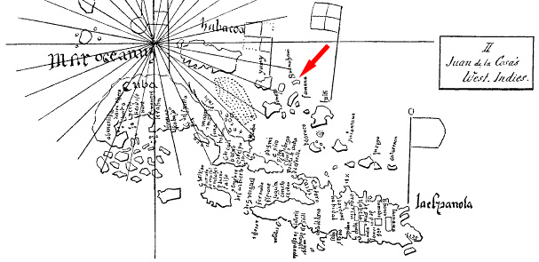
Image: Guanahani en mapa de la Cosa
No higher resolution available.
Guanahani_en_mapa_de_la_Cosa.jpg (607 × 295 pixels, file size: 97 KB, MIME type: image/jpeg)
Description: The region of the Greater Antilles in the map of de la Cosa. The red arrow points to Guanahani island. Original hand sketch by P.J.J. Valentini (1828-1899).
Title: Guanahani en mapa de la Cosa
Credit: Antillas_en_Cantino_y_de_la_Cosa_(Valentini,_1889).gif
Author: Antillas_en_Cantino_y_de_la_Cosa_(Valentini,_1889).gif: P.J.J. Valentini (1828-1899) *derivative work: Hispalois (talk)
Usage Terms: Public domain
License: Public domain
Attribution Required?: No
Image usage
The following page links to this image:

All content from Kiddle encyclopedia articles (including the article images and facts) can be freely used under Attribution-ShareAlike license, unless stated otherwise.