
Image: Guelph Downtown Aerial

Size of this preview: 800 × 581 pixels. Other resolutions: 320 × 232 pixels | 2,000 × 1,453 pixels.
Original image (2,000 × 1,453 pixels, file size: 2.39 MB, MIME type: image/jpeg)
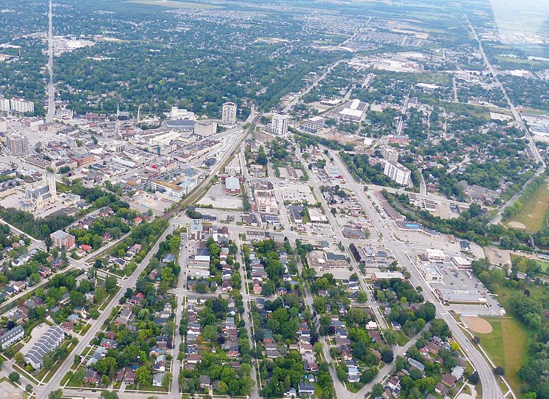
Description: Downtown Guelph from the air. The evolution of John Galt's radial street plan is evident. The road in the upper left of frame is Eramosa Road, which heads due north. At the right is York Road, Highway 7, that heads towards Rockwood. The four lane road on the lower right is Wellington Street. The photo was taken from a Cessna 152 C-FQZB owned by pilot Bill Carius.
Title: Guelph Downtown Aerial
Credit: Own work
Author: J. S. (Steve) Bond
Usage Terms: Creative Commons Attribution-Share Alike 4.0
License: CC BY-SA 4.0
License Link: https://creativecommons.org/licenses/by-sa/4.0
Attribution Required?: Yes
Image usage
The following page links to this image:

All content from Kiddle encyclopedia articles (including the article images and facts) can be freely used under Attribution-ShareAlike license, unless stated otherwise.