
Image: HRR 1648 Erz Bremen

Size of this preview: 782 × 600 pixels. Other resolutions: 313 × 240 pixels | 1,973 × 1,513 pixels.
Original image (1,973 × 1,513 pixels, file size: 218 KB, MIME type: image/png)
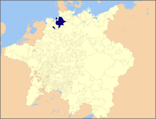
Description: Map of the Holy Roman Empire, 1648, with the territories formerly belonging to the prince-archbishop of Bremen highlighted
Title: HRR 1648 Erz Bremen
Credit: modified from File:Holy Roman Empire 1648 Ecclesiastical.png using information from Putzger Historischer Weltatlas (103rd ed., 2005)
Author: Roke (map), Hanno Sandvik (addition of colours)
Permission: released by the author under GNU
Usage Terms: Creative Commons Attribution-Share Alike 3.0
License: CC BY-SA 3.0
License Link: https://creativecommons.org/licenses/by-sa/3.0
Attribution Required?: Yes
Image usage
The following page links to this image:

All content from Kiddle encyclopedia articles (including the article images and facts) can be freely used under Attribution-ShareAlike license, unless stated otherwise.