
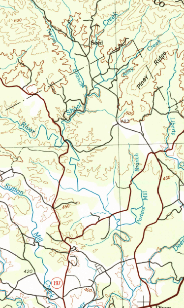
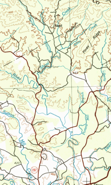
Image: HUC 031300010202 topographical map
Size of this preview: 359 × 599 pixels. Other resolutions: 144 × 240 pixels | 374 × 624 pixels.
Original image (374 × 624 pixels, file size: 407 KB, MIME type: image/png)
Description: HUC 031300010202 topographical map, using the 1981 Toccoa 30x60 grid, showing Shoal Creek and the Soque River
Title: HUC 031300010202 topographical map
Credit: GA_Toccoa_247664_1981_100000_geo.pdf downloaded from store.usgs.gov
Author: USGS
Usage Terms: Public domain
License: Public domain
Attribution Required?: No
Image usage
The following page links to this image:

All content from Kiddle encyclopedia articles (including the article images and facts) can be freely used under Attribution-ShareAlike license, unless stated otherwise.