
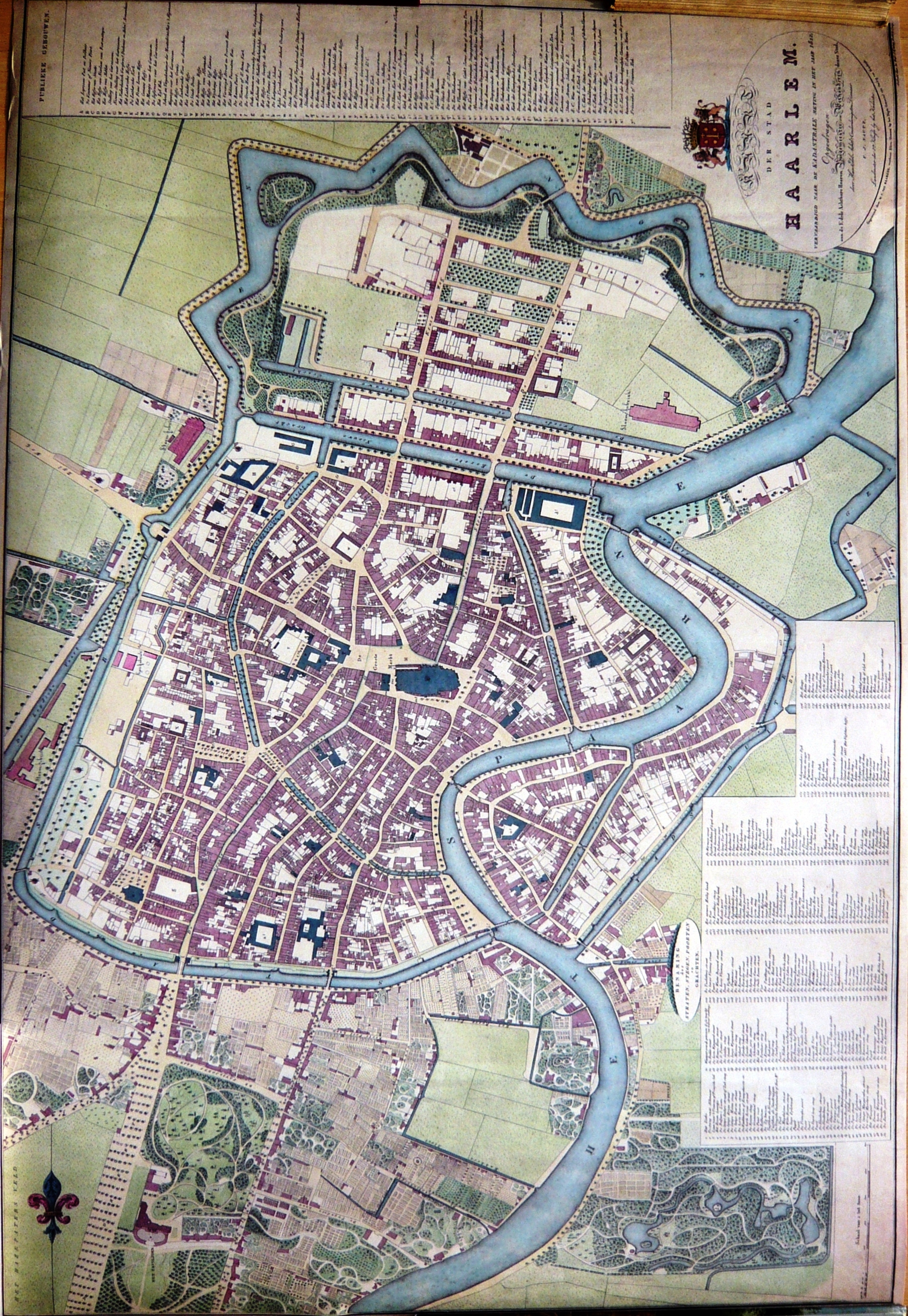
Image: Haarlem1827
Description: Map of Haarlem in 1827. Colored copper engraving by W.C. van Baarsel in Amsterdam. Source: Ferdinand Joseph Nautz(1785-1841) surveyor. Nautz was a member of a group of surveyors hired in 1817 to map the Dutch towns in order serve as a basis for taxes. The hand-colored and hand-drawn maps were created in 1822 by Nautz and his colleagues H.C. van Dooren and A. van Diggelen. They are in the possession of the National Archives. For the town of Haarlem, Nautz created a set of maps of Haarlem where not only ownership rights, but also houses were drawn. Quite popular, these maps were reproduced by book sellers and sold at the time for 3 guilders to travelers as the first city-maps. This set of maps belongs to the city of Haarlem, and has been used as the basis for city planning as late as 1900. In the archive museum of Haarlem, a model of the city is on show based on this map. (Key: Handwritten on map) List of Public Buildings:
Title: Haarlem1827
Credit: Own work Photo of 2002 reproduction of one of many copies of the 'Nautz of Haarlem' in possession of North Holland Archives. Archiefdienst voor Kennemerland; Historische Museum Haarlem
Author: Ferdinand Joseph Nautz
Usage Terms: Public domain
License: Public domain
Attribution Required?: No
Image usage
The following page links to this image:
