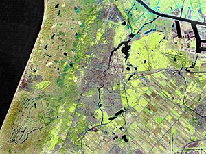
Haarlem facts for kids
Quick facts for kids
Haarlem
|
|||||
|---|---|---|---|---|---|
|
City and municipality
|
|||||
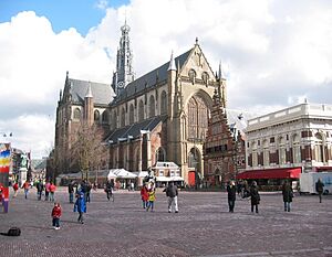
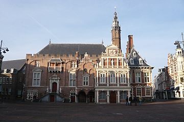
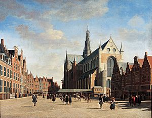
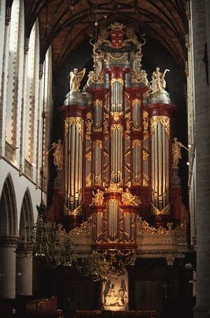
Grote Kerk ("Great Church") or St.-Bavokerk ("Church of St. Bavo") on the Grote Markt, Haarlem's central square
|
|||||
|
|||||
| Nicknames:
Bloemenstad (Flower City),
Spaarnestad (Spaarne City) |
|||||
| Motto(s):
Vicit vim virtus (Virtue conquered force)
|
|||||
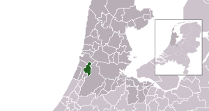
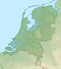
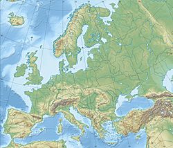
Location in North Holland
|
|||||
| Country | |||||
| Province | |||||
| Region | Amsterdam metropolitan area | ||||
| City Hall | Haarlem City Hall | ||||
| Government | |||||
| • Body | Municipal council | ||||
| Area | |||||
| • Municipality | 32.09 km2 (12.39 sq mi) | ||||
| • Land | 29.22 km2 (11.28 sq mi) | ||||
| • Water | 2.87 km2 (1.11 sq mi) | ||||
| Elevation | 2 m (7 ft) | ||||
| Population
(Municipality, May 2014; Urban and Metro, May 2014)
|
|||||
| • Municipality | 155,758 | ||||
| • Density | 5,331/km2 (13,810/sq mi) | ||||
| • Urban | 204,429 | ||||
| • Metro | 420,447 | ||||
| Demonym(s) | Haarlemmer | ||||
| Time zone | UTC+1 (CET) | ||||
| • Summer (DST) | UTC+2 (CEST) | ||||
| Postcode |
2000–2037, 2063
|
||||
| Area code | 023 | ||||
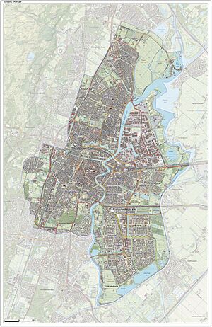
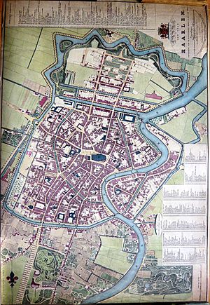
| Click on the map for a fullscreen view | |||||
Haarlem (Dutch pronunciation: [ˈɦaːrlɛm]) is a historic city and municipality in the Netherlands. It is the capital of the province of North Holland. Haarlem is located about 20 km (12 mi) west of Amsterdam. It is part of the larger Amsterdam metropolitan area. In 2014, Haarlem had a population of about 155,758 people.
Haarlem was officially granted city rights in 1245. This meant it could make its own rules and build defenses. The city has grown over time to include nearby areas like Schoten and parts of Bloemendaal and Heemstede. Today, the municipality of Haarlem also includes the western part of the village of Spaarndam.
Contents
Exploring Haarlem's Location
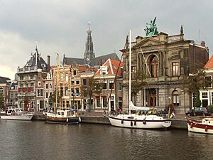
Haarlem is built along the Spaarne river, which is why it's sometimes called Spaarnestad (Spaarne city). It's also very close to the coastal dunes. For centuries, Haarlem has been famous for growing tulip bulbs, earning it the nickname Bloemenstad (flower city).
Haarlem Through Time
| Historical population | |||||||||||||||||||||||||||||||||||||||||||||||||||||||||||||||||||||||||||||||||||||||||||||||||
|---|---|---|---|---|---|---|---|---|---|---|---|---|---|---|---|---|---|---|---|---|---|---|---|---|---|---|---|---|---|---|---|---|---|---|---|---|---|---|---|---|---|---|---|---|---|---|---|---|---|---|---|---|---|---|---|---|---|---|---|---|---|---|---|---|---|---|---|---|---|---|---|---|---|---|---|---|---|---|---|---|---|---|---|---|---|---|---|---|---|---|---|---|---|---|---|---|---|
|
|
||||||||||||||||||||||||||||||||||||||||||||||||||||||||||||||||||||||||||||||||||||||||||||||||
| Source: (1398–1795) Statistics Netherlands (1850–Present) |
|||||||||||||||||||||||||||||||||||||||||||||||||||||||||||||||||||||||||||||||||||||||||||||||||
Haarlem has a long history, going back before the Middle Ages. It sits on a narrow strip of land called a "strandwal" (beach ridge), which is slightly higher than the surrounding water. This location helped Haarlem become rich by collecting tolls from ships and travelers passing through.
Over time, Amsterdam became the main city in North Holland. Haarlem became a quieter place, which is why many of its old medieval buildings are still standing today. Many of these buildings are now protected as Rijksmonuments, which are national heritage sites.
Haarlem's Early Days
The first mention of Haarlem is from the 10th century. Its name likely means "home on a forested dune." The city grew around a stream called "De Beek," which was later covered up as the city expanded. Haarlem was well-located by the Spaarne river and a main road. By the 12th century, it was a fortified town and a home for the Counts of Holland.
In 1219, Haarlem's knights were honored for helping to conquer the Egyptian port of Damietta during a crusade. Because of this, Haarlem was allowed to put the Count's sword and cross on its coat of arms. On November 23, 1245, Haarlem officially received city rights. This gave the city more control over its own laws and justice.
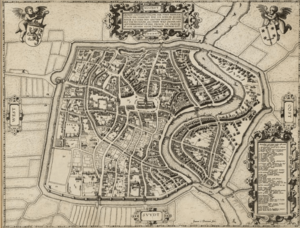
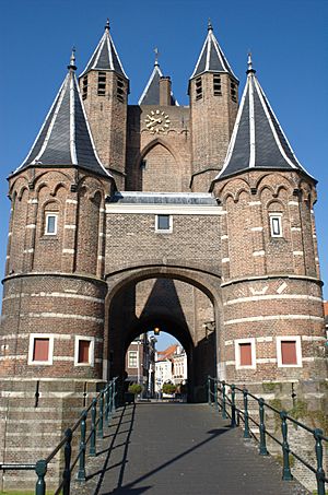
After a conflict in 1270, a defensive wall was built around Haarlem. The city grew, and by the end of the 14th century, a stronger, taller wall with a wide canal was built.
Fires were a big risk in the past because buildings were made of wood. In 1328, almost the entire city burned down. The Sint-Bavokerk was badly damaged and took over 150 years to rebuild. More fires in 1347 and 1351 destroyed many buildings, including the Count's castle. The Count gave the castle land to the city, and a new city hall was built there. The city was rebuilt quickly after each fire, showing how wealthy it was. In 1381, the Black Death arrived, killing about half the population.
By the 14th century, Haarlem was a very important city. It was the second largest city in Holland. It collected tolls from ships on the Spaarne river. Haarlem was known for its textile industry, shipyards, and beer breweries.
The Spanish Siege
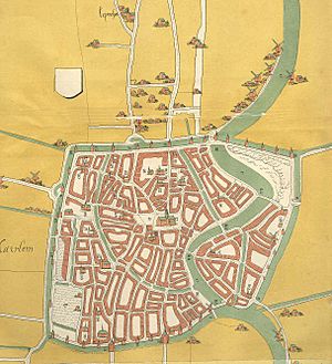
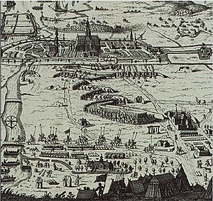
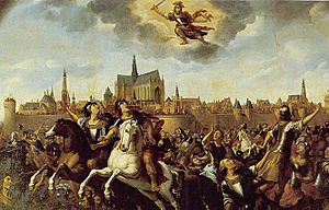
When the city of Brielle was taken by the Geuzen (Dutch rebels), Haarlem decided to support them. King Philip II of Spain sent an army to punish cities that resisted. On December 11, 1572, the Spanish army began to besiege Haarlem. The city's defenses were led by Wigbolt Ripperda. A brave widow named Kenau Simonsdochter Hasselaer is said to have helped defend the city with other women.
The siege lasted for seven months. The Spanish army dug tunnels to try and blow up the city walls, but the defenders dug their own tunnels to stop them. The situation became very difficult when the Spanish gained control of Haarlemmermeer lake, cutting off Haarlem from supplies. People in the city began to starve.
On July 13, 1573, Haarlem finally surrendered. Many defenders were killed, and the city had to pay a large sum of money to the Spanish. Even though Haarlem fell, its long resistance inspired other Dutch cities to keep fighting against the Spanish. The siege was very costly for the Spanish army, who lost about 12,000 soldiers.
Just a few years later, in October 1576, a large fire destroyed almost 500 buildings in Haarlem. This fire, combined with the damage from the siege, meant that about one-third of the city was destroyed.
Haarlem's Golden Age
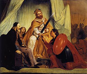
After the Spanish left in 1577, Haarlem worked to rebuild its economy. The city council welcomed immigrants, including many Flemish and French people who were fleeing Spanish rule. These new citizens brought skills in linen and silk making. Haarlem's population grew from 18,000 in 1573 to around 40,000 in 1622. At one point, more than half the population was born in Flanders! This period was part of the Dutch Golden Age, a time of great wealth and cultural growth in the Netherlands.
City Growth and Art
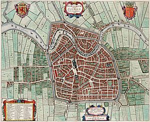
In 1632, the first tow canal in the country, the Haarlemmertrekvaart, was opened between Haarlem and Amsterdam. This made travel and trade easier. The city continued to grow, and in 1671, Haarlem expanded northwards. New canals and a new defensive wall were built.
Haarlem also became a center for art. Famous painters like Frans Hals and Jacob van Ruisdael, and architect Lieven de Key, lived and worked here. The city council even commissioned paintings to show off Haarlem's history and products.
On the Grote Markt, there is a statue of Laurens Janszoon Coster, who some people believe invented the printing press. While most scholars think Johann Gutenberg was the first, this story was popular in Haarlem and helped the city's printers. Many important Dutch history books from the Golden Age were published in Haarlem.
Beer and Tulips
Beer brewing was a very important industry in Haarlem. To get clean water for brewing, a special canal called the Brewers' Canal (Brouwersvaart) was dug to bring water from the dunes. In 1620, Haarlem had about one hundred breweries! However, the industry declined over time, and by 1820, there were no breweries left. In the 1990s, some old recipes were revived, and now you can find "Jopen" beer, brewed in a former church called the Jopenkerk. Another local brewery, Uiltje Brewing, opened in 2012.
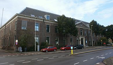
Since the 1630s, Haarlem has been a major trading center for tulips. It was at the heart of "tulip mania," when people paid incredibly high prices for tulip bulbs. The area south of Haarlem is still famous for its beautiful blooming bulb fields in spring.
Haarlem in the 18th and 19th Centuries
As trade shifted more towards Amsterdam, Haarlem became quieter in the 18th century. Many wealthy people from Amsterdam built summer homes in Haarlem, especially along the Spaarne river. Haarlem became a popular place for people to escape the busy city.
At the end of the 18th century, the French army entered Haarlem. The city's role became less important as the new national government was more centralized. Trade suffered because of conflicts with England.
In the early 19th century, Haarlem's textile industry struggled due to new production methods used in England. The city's population was around 17,000, and many people were poor. The old city walls were taken down and the bricks were used to build new factories and homes. Haarlem became the capital of North Holland province.
New Industries and Transport
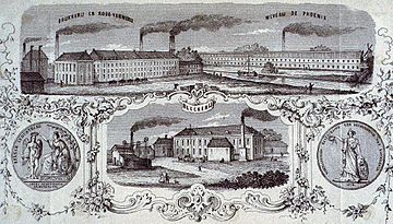
In the mid-19th century, Haarlem's economy slowly improved. New factories opened, including cotton mills. These mills produced goods for export, especially to the Dutch East Indies.
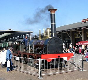
A very important development was the railway. On September 20, 1839, the first train service in the Netherlands started, connecting Haarlem and Amsterdam. The train traveled at about 40 km/h (25 mph). This made travel much faster and boosted Haarlem's economy. The old passenger boat service quickly stopped. Later, in 1878, a horse tram started in Haarlem, and in 1894, the first electric tram in the Netherlands ran here.
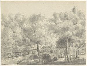
As the city grew and new land was created, the water in Haarlem's canals became polluted. In 1859, the Oude Gracht canal smelled so bad and caused health problems that it was filled in to create a new street.
City Expansion
From 1879 to 1909, Haarlem's population almost doubled. The city expanded rapidly, taking in nearby areas like the Leidsebuurt district. In 1927, the municipality of Schoten and parts of other villages became part of Haarlem, adding many new citizens.
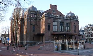
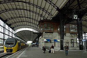
In 1908, a new railway station was opened with elevated tracks to improve city traffic. In 1911, Anthony Fokker famously flew his plane, "de Spin," around the Sint-Bavokerk. Later, the city expanded southwards and eastwards. In 1932, a large department store was built, but a small chemist's shop, "Van der Pigge," refused to move and is now surrounded by the larger building. Locals call them "David and Goliath."
Haarlem During World War II
During World War II, parts of Haarlem were evacuated by the German forces. The football stadium was even demolished. Many people had to leave their homes. Gas and electricity became very limited.
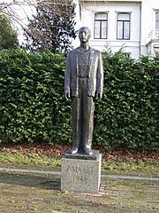
The family of Corrie ten Boom was arrested in February 1944 for hiding Jewish people and Dutch resistance fighters. The Dutch heroine Hannie Schaft, who worked for a resistance group, was captured and executed by the Germans just before the war ended in 1945. Despite these brave efforts, most Jewish people from Haarlem were deported. During the "Hunger Winter," people in Haarlem survived by eating tulip bulbs.
Haarlem After the War
After World War II, many large industries left Haarlem, and the focus of industry shifted to Amsterdam. However, new immigrants came to the city, especially from former Dutch colonies. This led to new building projects, and in 1963, many houses were built in Schalkwijk.
Religion in Haarlem
Haarlem has had a Christian church since the 9th century. The first church was made of wood and stood where the current Grote Kerk is today. This church was originally dedicated to the Virgin Mary but was later named after Saint Bavo, the patron saint of Haarlem.
In 1559, Haarlem became a Diocese. However, during a time of religious change, many Catholic symbols were removed from the Grote Kerk. After the Spanish siege, the church was attacked again, and the bishop had to flee. The city council took control of the Sint Bavo Kerk and turned it into a Protestant church, now called the Grote Kerk.
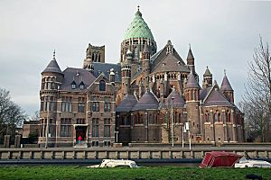
In the 19th century, new Catholic churches were built in the Netherlands. In Haarlem, the St. Joseph kerk was built in 1841. As this church grew, a new, larger cathedral, also called the Cathedral of Saint Bavo, was built in 1898. Haarlem also has an Old Catholic bishop and a small Jewish community with its own synagogue.
The Frans Hals Museum still has many items that were taken from the churches during these times of change.
Haarlem's Population
As of 2020, Haarlem had a total population of 162,090 people.
Where People Come From
| 2020 | Numbers | % |
|---|---|---|
| Dutch natives | 112,696 | 69.1% |
| Western migration background | 23,335 | 14.3% |
| Non-Western migration background | 26,871 | 16.4% |
| Turkey | 6,718 | 4.1% |
| Morocco | 5,393 | 3.3% |
| Indonesia | 4,634 | 2.84% |
| Netherlands Antilles and Aruba | 1,134 | 0.69% |
| Suriname | 2,211 | 1.35% |
| Total | 162,902 | 100% |
Fun Things to Do in Haarlem
Museums to Visit
Haarlem has several interesting museums:
- The Teylers Museum is the oldest museum in the Netherlands. It focuses on art, science, and natural history. It even has works by famous artists like Michelangelo and Rembrandt.
- The Frans Hals Museum displays Dutch master paintings. Its other location, De Hallen, shows modern art.
- The Archeologisch Museum Haarlem is in the cellar of the Vleeshal building.
- The Hoofdwacht building, on the Grote Markt, has exhibitions about Haarlem's history.
- Other museums include the Barrel Organ Museum Haarlem, Museum van de Geest (about the mind), and the Ten Boom Museum (a hiding place for Jews during World War II).
Theater, Film, and Music
Haarlem has many places for entertainment:
- The Philharmonie is a concert hall in the city center.
- Next to it is the Toneelschuur theatre, which also has movie theaters.
- The Stadsschouwburg is a large theater that reopened in 2008 after renovations.
- The only cinema in Haarlem is Pathé Haarlem, located in the Raaks shopping mall.
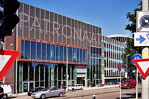
- The Patronaat is a popular pop music venue, one of the largest in the Netherlands.
Exciting Festivals
Haarlem hosts many fun festivals throughout the year:
- Every April, the bloemencorso (flower parade) takes place. Floats decorated with flowers travel from Noordwijk to Haarlem, where they are displayed.
- Also in April, a funfair is held on the Grote Markt.
- The annual Haarlem Jazz & More is a music festival.
- Haarlem Culinair is a food event.
- The biannual Haarlemse Stripdagen (Haarlem comic days) celebrates comics.
- Bevrijdingspop is a music festival held every year on May 5th to celebrate the Netherlands' liberation from the Nazis after World War II.
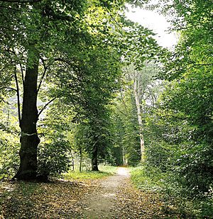
- The Haarlemmerhoutfestival, a music and theater festival, is also held at the Haarlemmerhout park.
Sports in Haarlem
Haarlem has many sports clubs. While its professional football club, HFC Haarlem, went bankrupt, the Koninklijke HFC (Royal Haarlemsche Football Club) is still active. It was founded in 1879 and is the oldest football club in the Netherlands!
Haarlem is also known for hosting international sports events:
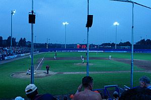
- The Haarlemse Honkbalweek (Haarlem Baseball Week) is held every two years.
- The Haarlem Basketball Classic is a basketball event.
- Haarlem also hosted the 2014 Women's Softball World Championship.
Getting Around Haarlem
Haarlem has two railway stations:
- From Haarlem railway station, you can take trains to Amsterdam (15-20 minutes), Leiden, The Hague, and Zandvoort aan Zee.
- Haarlem Spaarnwoude also has trains to Amsterdam.
The city also has many bus lines operated by Connexxion, connecting Haarlem to the surrounding region, including Amsterdam. There's even a special fast bus service called the Zuidtangent that goes from Haarlem to Amsterdam South East and Schiphol Airport.
Interesting Facts About Haarlem
Local Beer
Beer brewing was a huge industry in Haarlem centuries ago. In 1995, for the city's 750th anniversary, some enthusiasts recreated an old Haarlem beer recipe. This beer is called Jopenbier, or Jopen for short, named after an old type of beer barrel.
Harlem, New York
Did you know that the famous neighborhood of Harlem in New York City was named after Haarlem? In 1658, Peter Stuyvesant, the leader of the Dutch colony of New Netherland, founded a settlement called Nieuw Haarlem on Manhattan Island. When the English took over in 1664, they renamed the colony "New York" but kept the name Haarlem, changing its spelling to Harlem.
Lautje, the Statue on Grote Markt
On the main square, the Grote Markt, you'll find a statue of Laurens Janszoon Coster, nicknamed 'Lautje' by locals. Some people believe he invented the printing press with movable type, at the same time as Johannes Gutenberg.
New University Campus
In 2022, the SRH group of universities opened a campus in Haarlem. It's located at the site of a former prison, called the Cupola prison.
Meat Advertisement Ban
Haarlem is set to be the first city in the world to ban most meat advertisements from public spaces starting in 2024. This is because of the environmental impact of food production.
Sister Cities
Haarlem is twinned with these cities:
|
See also
 In Spanish: Haarlem para niños
 | Madam C. J. Walker |
 | Janet Emerson Bashen |
 | Annie Turnbo Malone |
 | Maggie L. Walker |


