Aruba facts for kids
Quick facts for kids
Aruba
|
|||
|---|---|---|---|
| Country of Aruba Land Aruba (Dutch) Pais Aruba (Papiamento) |
|||
|
|||
| Anthem: "Aruba Dushi Tera" (English: "Aruba, Sweet Land") |
|||
| Royal anthem: "Wilhelmus" (English: "William of Nassau") |
|||
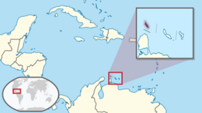
Location of Aruba (circled in red)
|
|||
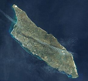
Satellite view of Aruba
|
|||
| Sovereign state | |||
| Before separation | Netherlands Antilles | ||
| Country status | 1 January 1986 | ||
| Capital and largest city
|
Oranjestad 12°31′7″N 70°2′9″W / 12.51861°N 70.03583°W |
||
| Official languages | |||
| Other languages | Spanish, English | ||
| Ethnic groups
(2020)
|
|
||
| Demonym(s) | Aruban | ||
| Government | Devolved parliamentary representative democracy within a constitutional monarchy | ||
|
• Monarch
|
Willem-Alexander | ||
|
• Governor
|
Alfonso Boekhoudt | ||
| Evelyn Wever-Croes | |||
| Legislature | Parliament of Aruba | ||
| Area | |||
|
• Total
|
180 km2 (69 sq mi) (189th) | ||
|
• Water (%)
|
negligible | ||
| Highest elevation | 188 m (617 ft) | ||
| Population | |||
|
• 2022 estimate
|
106,203 (180th) | ||
|
• 2020 census
|
108,166 | ||
|
• Density
|
560.4/km2 (1,451.4/sq mi) | ||
| GDP (PPP) | 2023 estimate | ||
|
• Total
|
|||
|
• Per capita
|
|||
| GDP (nominal) | 2023 estimate | ||
|
• Total
|
|||
|
• Per capita
|
|||
| Currency | Aruban florin (ƒ) (AWG) | ||
| Time zone | UTC−4:00 (AST) | ||
| Mains electricity | 127 V/60 Hz | ||
| Driving side | right | ||
| Calling code | +297 | ||
| ISO 3166 code |
|
||
| Internet TLD | .aw | ||
| Website | (government), (tourism board) | ||
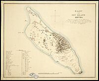
Aruba is a beautiful island country in the southern Caribbean Sea. It's officially called the Country of Aruba. The island is part of the Kingdom of the Netherlands, along with the Netherlands, Curaçao, and Sint Maarten. Aruba is located about 29 kilometers (18 miles) north of Venezuela.
Aruba is about 32 kilometers (20 miles) long and 10 kilometers (6 miles) wide. It forms a group called the ABC islands with Bonaire and Curaçao. These islands are part of the Dutch Caribbean. Aruba is home to about one-third of the people living in the Dutch Caribbean.
In 1986, Aruba became its own country within the Kingdom of the Netherlands. Even though it's a separate country, its citizens share Dutch nationality. Aruba doesn't have smaller administrative areas, but it's divided into eight regions for counting people. Its capital city is Oranjestad.
Unlike many other Caribbean islands, Aruba has a dry climate. It's usually warm and sunny all year round. The island covers about 179 square kilometers (69 square miles) and had a population of 108,166 people in 2020.
Contents
- What's in a Name? The History of Aruba's Name
- Aruba's Past: A Journey Through Time
- Aruba's Natural Beauty: Geography and Climate
- Who Lives in Aruba? The People and Their Culture
- Learning in Aruba: The Education System
- Aruba's Economy: How the Island Makes Money
- Aruba's Culture: Traditions and Celebrations
- Aruba's Infrastructure: Getting Around and Staying Connected
- Places to Visit in Aruba
- Famous People from Aruba
- See Also
What's in a Name? The History of Aruba's Name
The name Aruba probably comes from the Caquetío word Oruba, which means "Well situated island." The Caquetío people were living on the island when Alonso de Ojeda first arrived. Between 1529 and 1648, the Spanish called the island "Isla de Oruba." After the island became Dutch, its name slowly changed to Aruba.
Other Native American groups had different names for the island too. The Caquetío also called it Oibubia, meaning "Guided island." The Taino people called it Arubeira. The Kalinago had two names: Ora Oubao ("Shell island") and Oirubae ("Companion of Curaçao").
Some people mistakenly think "Aruba" comes from the Spanish phrase Oro hubo, which means "There was gold once." However, the Spanish actually called these islands islas inútiles, meaning "useless islands," because they didn't find much gold. Gold was only discovered in Aruba much later, in 1824, by a 12-year-old boy named Willem Rasmijn. This discovery led to the Aruban Gold Rush.
Aruba's Past: A Journey Through Time
Early People: The Pre-Ceramic Age
Aruba's very first inhabitants lived during the Archaic or Pre-Ceramic period. These early people were hunters, fishers, and gatherers. They relied heavily on food from the sea. They didn't use pottery or practice farming.
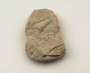
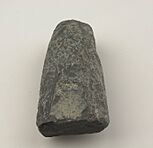
These ancient Arubans made tools and weapons from stone. They would chip, polish, and sharpen stones to create axes, chisels, and knives. One important site, Sero Muskita, shows tools that are even older than others found on the island. This suggests that people might have visited Aruba from the mainland a very long time ago. So far, 33 ancient sites from this period have been found on Aruba.
Ancient Travelers and Cultural Connections
During this time, the Leeward Islands, including Aruba, traded with people from mainland South America. This was especially true for areas in what is now Venezuela and Colombia. Scientists found 60 to 70 ancient burial sites in Malmok and Canashito, Aruba. Five of these sites are from 100 BC to 100 AD.
Interestingly, tests on one person buried there showed they were not from Aruba. Their diet was different from the others, who were from Aruba. This tells us that early people traveled and shared cultures even back then.
Later, a burial site in Malmok from 450 to 1000 AD showed that ancient Arubans were short and strong. Men were about 1.57 meters (5.15 feet) tall, and women were about 1.49 meters (4.89 feet) tall. Their burial customs suggest they traveled in groups of 15 to 30 people. An adult man, likely a leader, was buried in the center of the group, with stones marking his grave.
The Caquetío People: A New Era
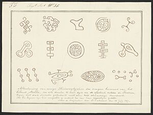
Around 950 AD, the ancient people of Aruba disappeared from the records. Soon after, the Caquetío people arrived. They had more advanced ways of living and better tools. It's possible the Caquetío lived alongside the older groups for a while. Eventually, they might have taken over or blended with them.
Who Were the Caquetío?
By the year 1500, the Caquetío people lived on Aruba. They were part of the Arawak people. The Arawak civilization started in the Amazon region. Between 850 and 1000 AD, Caquetío Indians moved from western Venezuela to the Leeward Antilles. They brought pottery and farming to the islands.
Caquetío Leaders and Society
The Caquetío people had a well-organized society led by a spiritual leader called a diao. This leader had both religious and everyday power. The diao could marry many wives, which helped him form alliances with other groups. Their society was organized but not based on harsh rule. This system was interrupted when the Spanish arrived.
Farming, Trading, and Connections
The Caquetío likely used a farming method called slash-and-burn. They grew crops and fished, but they also traded for things they couldn't find on the island. In the 1500s, they traded salt, canoes, tobacco, and beads. The Caquetío on Aruba were not isolated. They were part of a larger network with other groups in the region.
Burial Customs
The Caquetío buried their dead in groups, sometimes in large pots. A smaller pot was placed upside down on the head. Some pots even contained special items like axes or shells. This way of burying people was also practiced in South America.
The Last Native Aruban
Nicolaas Pyclas is known as the last native Aruban. He spoke the language of Aruba's original people and followed their customs. He lived in a hut in Savaneta. He ate sea snails and wild herbs. Around 1840, he was found dead. His skull was later given to a museum in the Netherlands.
Spanish Rule: Early European Contact
Searching for India
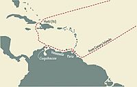
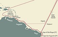
Christopher Columbus was looking for a new way to reach India, not a new continent. India was known for its riches like spices, pearls, and silk. Columbus thought he could reach India by sailing west across the Atlantic Ocean.
During his third trip, Columbus explored parts of Venezuela. He found the fresh water of the Orinoco Delta. He began to suspect he had found a large landmass, not just islands near India. Columbus died in 1506, still believing he had found new islands near India. He called the people he met "Indians."
First Maps and Rules
In 1500, Juan de la Cosa drew the first map of the New World. It showed two Leeward Antilles islands. A more accurate map in 1502 showed a large landmass and mentioned "Island of Giants" and "Island of Brasil." These likely referred to Bonaire and Curaçao.
In 1493, the Pope gave the Spanish Crown the right to control the newly discovered lands. Spain promised to teach the native people about the Catholic faith. This meant the Spanish government had a lot of religious power in the Americas.
The Conquistadors Arrive
Conquistadors were Spanish explorers and conquerors. They were interested in legends of gold. Their arrival brought difficult times for the native people, including forced changes to their way of life. Europeans had stronger weapons like firearms and steel swords, and they used horses.
The Spanish leaders often came from important families, but their soldiers were usually from the lower classes. These soldiers often became encomenderos, who had the right to make native people work and pay taxes. Native communities had to give up part of their crops. Many native people were also taken as forced laborers to other parts of the New World.
The Caquetío people of the Leeward Antilles became part of the Spanish colonial empire around 1500. In 1501, Alonso De Ojeda was given the right to explore the Venezuelan coast and the islands of Curaçao, Aruba, and Bonaire. He was told not to enslave natives. However, De Ojeda was not a good administrator and caused many problems. He set up a base to trade and conduct raids, including slave hunts. His attempts to control the region failed. He died poor in 1515 or 1516.
Between 1513 and 1515, many native people were removed from Curaçao, Aruba, and Bonaire. About 2,000 native people from these islands were taken to Hispaniola to work. Many faced very hard times, and some did not survive. Later, new native people came to Aruba from the mainland. The native people on the islands lost their independence.
The Spanish found that exploiting the Caribbean islands was not very profitable. Gold mining declined. In 1569, the Spanish Crown banned new settlements on most Caribbean islands. This made the islands open for other European countries like England, France, and the Netherlands to explore trade and even piracy.
Aruba Becomes a Spanish Ranch
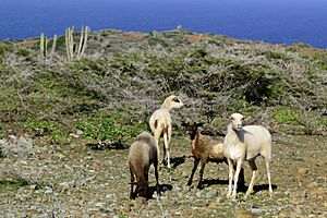
The Spanish brought European animals like goats, sheep, dogs, donkeys, cows, and pigs to Aruba. Aruba became like a large Spanish ranch, with cattle roaming freely. Even though there were more trees back then, the island looked similar to today. Horses brought by the Spanish had very hard hooves from roaming freely. A small group of Spaniards would sometimes visit, but Aruba was mostly left to itself. In 1630, there were "few Indians and some Spaniards" on Aruba.
Dutch Arrival: The Quest for Salt
The Dutch Need for Salt
The Dutch needed salt for their growing herring fishing industry. Salt was important for preserving fish, butter, and cheese, and for long sea voyages. They used to get salt from Portugal, but the Eighty Years' War (a war between Spain and the Netherlands) stopped this trade in 1585. This forced the Dutch to look for new sources of salt.
They searched in places like the Cape Verde Islands and Brazil. Eventually, they found large salt reserves in Punta de Araya, Venezuela. However, after a truce, the Spanish fortified these saltpans, and the Dutch lost access.
The Dutch then formed the West India Company (WIC). Its main goal was to fight Spain and capture Spanish ships. A secondary goal was trade and colonization. In 1623, the WIC sent ships to the Caribbean. During this trip, the Dutch first saw Aruba.
The Dutch herring industry was very important in the 1600s. Around 1628 or 1629, the Dutch started getting salt from Tortuga. The WIC realized they needed a base in the Caribbean to secure salt. Johannes van Walbeeck was chosen to lead an expedition and become Governor of Curaçao, Bonaire, and Aruba.
Curaçao was captured by the WIC in June 1634, mainly for its salt. In his report, Van Walbeeck mentioned Aruba and Bonaire as "islands of Curaçao." Spain regretted neglecting these "useless islands" as they fell under foreign control. However, the natural salt pans in Aruba were not very good. Aruba's salt production was just enough for local needs.
Aruba in the 1600s
Between 1648 and 1687, the Dutch Antilles and the Caribbean faced many challenges. By 1648, Curaçao was no longer as important as a military base. Governor Peter Stuyvesant wanted to connect the islands with New Netherland (now New York). He hoped New Netherland would send food, and Curaçao would send enslaved people, Aruba horses, and Bonaire salt.
However, the colonies didn't work well together. People in Curaçao preferred to trade with other Caribbean islands for better prices. They also traded illegally with the Spanish mainland. The relationship between the Curaçao islands and New Netherland ended in 1664 when an English fleet captured New Amsterdam.
The Dutch fought three wars with England in the 1600s. The second war (1665–1667) had a big impact on the Caribbean. After this war, Dutch power in the Caribbean lessened. However, the islands eventually became stable and prosperous again.
Slavery in Aruba
In the 1500s, the Spanish forced Arawak Indians to work, sending them to Hispaniola in 1515. Native people on the "useless islands" faced similar hardships to later African slaves, losing their freedom and being forced to work.
After 1775, the names of African slaves started appearing in records. The Dutch also recognized "red slavery," meaning enslaved Native Americans captured in wars. While Native Americans on Aruba were not officially called slaves under Dutch rule, old stories mention them being treated like slaves in the early 1900s.
In 1827, Commander Simon Plats found 51 Native Americans being treated like pseudo-slaves by Aruban families. Plats made the masters sign a paper saying these Native Americans were free. They had to ensure they were raised, educated, and housed properly.
Contrary to what some believe, Aruba did have slavery. Records are limited, but by 1862, 15 percent of Aruba's population were slaves. In 1820, a report showed 331 slaves in Aruba: 157 Native Americans and 174 of African descent. By 1840, the number grew to 497 slaves, with about half being Native American and half African. Even though Dutch law generally banned enslaving Native Americans, it still happened.
British Control and Economic Changes
During the Napoleonic Wars, the British took control of Aruba from 1806 to 1816. After that, it was returned to the Dutch. Aruba then became part of the Colony of Curaçao and Dependencies. In the 1800s, Aruba's economy grew with gold mining, phosphate production, and the aloe vera industry. Despite these activities, Aruba was still a developing and less wealthy region during this time.
Aruba in the 20th and 21st Centuries

In 1924, the first oil refinery, Lago Oil and Transport Company, was built in San Nicolas. Another refinery, Arend Petroleum Company, was built in 1927. These refineries processed oil from Venezuela, bringing more wealth to the island.
During World War II, the Netherlands was occupied by Nazi Germany. In 1940, Aruba's oil facilities came under the control of the Dutch government in London. The German navy attacked them in 1942.
In 1947, Aruba created its first constitution to become an autonomous state within the Kingdom of the Netherlands. By 1954, the Charter of the Kingdom of the Netherlands was set up, creating the Netherlands Antilles. This united all Dutch colonies in the Caribbean. Many Arubans were unhappy, feeling that Curaçao dominated the new structure.
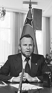
In 1972, Betico Croes, an Aruban politician, suggested creating a Dutch Commonwealth with Aruba, the Netherlands, Suriname, and the Netherlands Antilles as separate states. Croes wanted more independence for Aruba. In 1976, Aruba adopted its own flag and national anthem. In 1977, a vote was held, and 82% of people voted for complete independence from the Netherlands. Croes pushed the Dutch government by organizing a general strike.
Aruba Gains Autonomy
In March 1983, Aruba reached an agreement for its independence, to happen in steps. In August 1985, Aruba approved its own constitution. On January 1, 1986, Aruba officially separated from the Netherlands Antilles. It became a country within the Kingdom of the Netherlands, with full independence planned for 1996.
Sadly, Betico Croes was seriously injured in an accident in 1985 and died in 1986. He never saw Aruba gain its special status. After his death, Croes was called Libertador di Aruba (Liberator of Aruba). His successor, Henny Eman, became Aruba's first Prime Minister.
In 1985, Aruba's oil refinery closed. This was a big blow to the economy, as it provided a lot of income. The island then focused on growing its tourism industry, which is now its largest. In 1990, Aruba's Prime Minister Nelson Oduber asked to postpone full independence indefinitely. The plan for complete independence was removed in 1995, but it could be brought back with another vote.
Aruba's Natural Beauty: Geography and Climate
Aruba is located 77 kilometers (48 miles) west of Curaçao and 29 kilometers (18 miles) north of Venezuela.
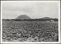
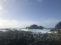
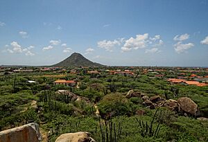
Aruba has three main types of landscapes. The northwestern part has flat, rocky areas with hills like Hooiberg and rock formations like Ayo and Casibari. The northeastern part has older rock formations and rolling hills, including Jamanota. This area is home to Arikok National Park. Finally, limestone terraces surround these two areas. The low limestone areas have white sandy beaches. The high plateaus on the north side are hit by rough ocean waters, creating caves and small natural bridges.
Aruba's dry landscape is partly due to its climate. However, it's also a result of a lot of trees being cut down during Spanish rule. Because of this, plants like aloe vera grow well in the calcium-rich soil. In 2022, only 2.3% of Aruba's land was covered by forest.
Aruba also has natural channels called rooi or gullies that carry rainwater to dams and the ocean. Besides Arikok National Park, the Bubali Bird Sanctuary is the only other important body of water on the island. It's a protected nature reserve and a brackish water lagoon.
Aruba's Regions: How the Island is Divided
Aruba is divided into eight regions for counting people. These regions don't have administrative power, but some match up with church areas and have community facilities.
| Name | Area (km2) | Population 1991 census |
Population 2000 census |
Population 2010 census |
Population 2020 census |
|---|---|---|---|---|---|
| Noord | 34.62 | 10,056 | 16,944 | 21,495 | 24,193 |
| Oranjestad West | 9.29 | 8,779 | 12,131 | 13,976 | 13,735 |
| Oranjestad Oost | 12.88 | 11,266 | 14,224 | 14,318 | 14,923 |
| Paradera | 20.49 | 6,189 | 9,037 | 12,024 | 13,834 |
| San Nicolaas Noord | 23.19 | 8,206 | 10,118 | 10,433 | 9,940 |
| San Nicolaas Zuid | 9.64 | 5,304 | 5,730 | 4,850 | 4,235 |
| Santa Cruz | 41.04 | 9,587 | 12,326 | 12,870 | 15,236 |
| Savaneta | 27.76 | 7,273 | 9,996 | 11,518 | 11,955 |
| Total Aruba | 178.91 | 66,687 | 90,506 | 101,484 | 108,166 |
Aruba's Unique Plants and Animals
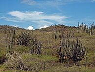
Aruba's plants are different from typical tropical islands. The landscape has many cacti, thorny bushes, and evergreen plants. Aloe vera also grows here, and it's so important that it's on Aruba's coat of arms.
You'll see cacti like Melocactus and Opuntia. Drought-resistant trees like Caesalpinia coriaria are also common.
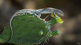
Because Aruba is separated from South America, it has unique animals found nowhere else. These include the Aruban Whiptail lizard, the Aruba Rattlesnake, and special kinds of Burrowing Owls and Brown-throated Parakeets.
Aruba's Weather: Sunny and Dry
Aruba has a hot semi-arid climate, meaning it's dry with little rainfall. It gets only about 500 millimeters (20 inches) of rain each year. Even during its "rainy season," Aruba stays quite dry.
The dry landscape is a direct result of this limited rain. In Oranjestad, temperatures are steady, usually between 27.0°C (80.6°F) and 29.6°C (85.3°F). This stable temperature is thanks to constant trade winds from the northeast.
Rainfall in Aruba can vary a lot. Some years, it gets as little as 150 millimeters (6 inches). In other years, it can get over 1000 millimeters (39 inches).
The short rainy season is from September to January. During this time, moist winds bring more frequent rain. Aruba is located south of the main area where tropical cyclones form, so it usually avoids direct hits from hurricanes. However, in late 2020, the island was affected by two hurricanes in their early stages.
Who Lives in Aruba? The People and Their Culture
| National origins | ||||
|---|---|---|---|---|
| Nationality | percent | |||
| Aruban | 66% | |||
| Colombian | 9.1% | |||
| Other | 6.2% | |||
| Dutch | 4.3% | |||
| Dominican | 4.1% | |||
| Venezuelan | 3.2% | |||
| Curaçaoan | 2.2% | |||
| Haitian | 1.5% | |||
| Surinamese | 1.2% | |||
| Peruvian | 1.1% | |||
| Chinese | 1.1% | |||
Aruba's population is very diverse. About 66% of people were born in Aruba. Other large groups include Colombians (9.1%), Dutch (4.3%), and Dominicans (4.1%). In 2019, about 17,000 Venezuelan refugees lived in Aruba, making up about 15% of the island's population.
Most of Aruba's people are of mixed heritage, about 75%. They come from Caquetío people, Dutch and Spanish settlers, African slaves, and other groups like Venezuelans, Colombians, and Chinese. Aruba has a strong Arawak heritage, even though there are no full-blooded Native Americans left.
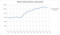
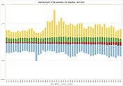
Aruba's population has changed over the years, mostly due to people moving in or out. Between 1988 and 2016, the population almost doubled. However, it decreased in 2017 and during the pandemic years (2020–2022) due to fewer births and less immigration. As of early 2023, Aruba's population was 107,354 people, showing a small increase from the previous year.
Languages Spoken in Aruba
| Primary Language of Arubans | ||||
|---|---|---|---|---|
| Languages | percent | |||
| Papiamento | 63.3% | |||
| Dutch | 15% | |||
| Spanish | 11.5% | |||
| English | 5% | |||
| Chinese | 1.4% | |||
| None | 1.5% | |||
| Other | 1.7% | |||
| Not Stated | 0.4% | |||
| Housing census 2010 | ||||
Aruba has two official languages: Dutch and Papiamento. Dutch is used for government and legal matters. However, Papiamento is the main language spoken by people every day. Papiamento is a mix of Spanish and Portuguese, with words from Caquetio, Dutch, African languages, and English. English and Spanish are also widely spoken because of tourism. Other languages you might hear include Portuguese, Cantonese, French, and German.
The Aruban government is becoming more interested in the cultural importance of Papiamento. While spoken Papiamento is similar across the islands, the written form is different. Aruba uses a spelling that focuses on the word's origin, while Curaçao and Bonaire use a phonetic spelling.
In the 1600s, people on Aruba already spoke Spanish. Spanish became important in the 1700s because of trade with Spanish colonies in Venezuela and Colombia. Today, about 13% of the population speaks Spanish as their first language. English became common in the early 1800s when the British controlled the island.
Aruba has newspapers in Papiamento, English, and Dutch. It also has 18 radio stations and two local TV channels.
Religion in Aruba
| Religions of Aruba | ||||
|---|---|---|---|---|
| Religions | percent | |||
| Roman Catholic | 75.3% | |||
| None | 5.5% | |||
| Protestant | 4.9% | |||
| Other | 4.4% | |||
| Jehovah's Witness | 1.7% | |||
| Unspecified | 0.5% | |||
Roman Catholicism is the main religion in Aruba, followed by about 75% of the people. Many other religions are also practiced, including Protestantism, Islam, Hinduism, and Judaism.
Special Religious Sites
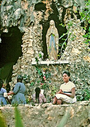
The Lourdes Grotto is a special religious site built in 1958. It's located in the rocks of Seroe Preto, near San Nicolas. Inside the cave, there's a 700 kg (1,500 lb) statue of the Virgin Mary. Every year on February 11, a procession goes from St. Theresita Church to the grotto for a Mass.
Learning in Aruba: The Education System
Historically, Dutch was not widely spoken in Aruba, except by the government. Its use grew in the late 1800s and early 1900s. Before that, students were mostly taught in Spanish. Today, Dutch is the main language for teaching in Aruba. Papiamento is taught as a subject in the lower grades of high school.
Aruba's education system is similar to the Dutch system. The government funds public schools. There are also private schools, like the International School of Aruba.
Aruba has three medical schools: American University School of Medicine Aruba (AUSOMA), Aureus University School of Medicine, and Xavier University School of Medicine. The island also has its own national university, the University of Aruba.
Aruba's Economy: How the Island Makes Money
Aruba's economy relies on four main areas: tourism, aloe export, petroleum refining, and offshore banking. Aruba has one of the highest standards of living in the Caribbean. In 2017, the average income per person was estimated to be $37,500. Its main trading partners are Colombia, the United States, Venezuela, and the Netherlands.
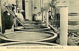
Farming and manufacturing are small parts of the economy. Gold mining was important in the 1800s. Aloe was brought to Aruba in 1840 and became a big export by 1890. At one point, two-thirds of the island was covered in aloe vera fields, and Aruba was the world's largest exporter of aloe. The industry still exists today, but on a smaller scale.
Aruba uses more natural resources than it has. In 2016, Aruba used almost 12 times the resources its land could provide.
The Aruban florin, Aruba's currency, is linked to the US dollar. One US dollar is worth 1.80 Aruban florins. Because many tourists are from the US, businesses in tourist areas often prefer to use US dollars.
Aruba is a wealthy country. Unemployment is low, and income per person is one of the highest in the Caribbean.
Until the mid-1980s, oil refining was Aruba's main industry. When the refinery closed, the island's economy shifted to tourism. Today, Aruba welcomes over a million visitors each year, mostly from the United States. Tourism mainly focuses on the beaches and the sea. The refinery has opened and closed several times over the past decades.
Until 2009, the Netherlands provided financial aid to Aruba for things like law enforcement, education, and healthcare. Aruba asked for this aid to stop in 2009. However, since 2015, some financial oversight has returned because Aruba's debt has grown significantly.
Aruba also has two free trade zones where import, export, and services are tax-free.
Tourism: Aruba's Biggest Industry
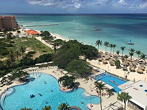
Aruba has a large and well-developed tourism industry. In 2018, 1,082,000 tourists stayed overnight. About three-quarters of Aruba's income comes from tourism. Most tourists are from North America (73.3%), followed by Latin America (15.2%) and Europe (8.3%).
For private planes flying to the United States, Queen Beatrix International Airport has a special pre-clearance facility. This means passengers can go through US customs and border checks in Aruba before flying. Since 2008, Aruba has been the only island with this service for private flights.
Aruba's Culture: Traditions and Celebrations
Aruba has a very diverse culture. In 2005, people from 92 different countries lived on the island. Dutch influence is still strong. For example, they celebrate Sinterklaas (Saint Nicholas) on December 5 and 6. They also celebrate Koningsdag (King's Day) on April 27, like the rest of the Kingdom of the Netherlands.
March 18 is Aruba's National Anthem and Flag Day. Christmas and New Year's Eve are celebrated with special music and songs. Traditional foods like ayaca and ponche crema are also part of the holidays. January 25 is Betico Croes Day, and June 24 is Dia di San Juan. Religious holidays like the Feast of the Ascension and Good Friday are also observed.
Aruba's Carnaval is a huge cultural event, similar to celebrations in other Caribbean and Latin American countries. It started in the 1950s, influenced by people from Venezuela and nearby islands who worked at the oil refinery. Carnaval celebrations now last from early January until the Tuesday before Ash Wednesday, with a big parade on the last Sunday.
American culture has also influenced Aruba due to more tourists from the United States. This can be seen in celebrations like Halloween in October and Thanksgiving Day in November.
Architecture: A Mix of Styles

From the start of Dutch colonization until the early 1900s, Aruba's buildings were influenced by Dutch colonial style. They also had some Spanish elements from Catholic missionaries. After the oil and tourism industries grew in the 1900s, American and international styles became popular. You can still see Art Deco buildings in San Nicolas. So, Aruba's architecture is a mix of Spanish, Dutch, American, and Caribbean influences.
Sports: Popular Activities on the Island
The most popular sports in Aruba are football, basketball, baseball, and volleyball. Beach sports are also very popular. Aruba has competed in the Olympic Games since 1988.
Aruba's Infrastructure: Getting Around and Staying Connected
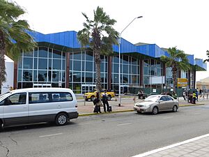
Aruba's Queen Beatrix International Airport is located near Oranjestad.
Aruba has four ports: Barcadera (the main cargo port), Paardenbaai (the cruise ship terminal in Oranjestad), Commandeurs Baai in Savaneta, and Sint Nicolaas Baai in San Nicolaas. Paardenbaai serves many cruise lines. Almost one million tourists arrive at this port each year. The Aruba Ports Authority, run by the Aruban government, manages these seaports.
Arubus is a government-owned bus company. Its buses run almost all day, every day of the year. Private minibuses also serve areas like the Hotel Area, San Nicolaas, Santa Cruz, and Noord.
A streetcar service runs on rails along the main street of Oranjestad.
Utilities: Power and Water
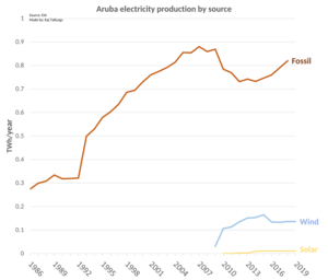
Water- en Energiebedrijf Aruba, N.V. (W.E.B.) produces drinking water and electricity. Aruba uses about 35,600 cubic meters (46,500 cubic yards) of water per day. The average power generation is 104 megawatts. W.E.B. also handles water distribution. Elektriciteits Maatschappij Aruba, N.V. (N.V. Elmar) is the only electricity distributor. N.V. Elmar also allows customers to add solar panels or wind turbines. The Sunrise Solar Park opened in 2018.
Waste Management: Keeping Aruba Clean
Aruba has three sewage plants: Zeewijk, Parkietenbos, and Bubali. The Bubali plant is 40 years old and processes over 8,000 cubic meters (10,000 cubic yards) of water per day, which is double its original capacity due to Aruba's growth.
The main landfill for solid waste is at Parkietenbos. It has been there since the 1950s and can handle between 130 and 150 kilotons of waste per year. Sometimes, large fires happen there, causing pollution.
Communications: Staying Connected
Aruba has two main telecommunications companies: the government-owned Setar and the private company Digicel. Digicel competes with Setar in wireless services.
Places to Visit in Aruba
- Alto Vista Chapel
- Arikok National Park
- Ayo and Casibari Rock Formations
- Bushiribana and Balashi
- California Lighthouse
- Frenchman's Pass
- Hooiberg
- Jamanota
- Natural Pool
- Quadiriki Caves
- Sint Nicolaas
- Lago Colony
- Beaches of Aruba
Famous People from Aruba
- Dave Benton, Aruban-Estonian musician
- Alfonso Boekhoudt, 4th Governor of Aruba
- Xander Bogaerts, shortstop in MLB
- Betico Croes, political activist
- Denzel Dumfries, footballer for the Netherlands national team and Inter Milan
- Nydia Ecury, writer
- Henny Eman, first Prime Minister of Aruba
- Mike Eman, 3rd Prime Minister of Aruba
- Bobby Farrell, musician, former and male member of Boney M.
- Frans Figaroa, Lieutenant Governor of Aruba 1979–1982
- Henry Habibe, poet
- Andrew Holleran, novelist
- Maria Irausquin-Wajcberg, first elected female politician in Aruba
- Olindo Koolman, 2nd Governor of Aruba
- Juan Lampe, musician
- Macuarima, first Aruban Amerindian Chief killed by colonist
- Calvin Maduro, pitcher in MLB
- Hedwiges Maduro, former footballer and now a coach.
- Jossy Mansur, editor of the Papiamento language newspaper, Diario
- Diederick Charles Mathew, politician
- John Merryweather (1932–2019), first Minister Plenipotentiary of Aruba
- Nelson Oduber, 2nd Prime Minister of Aruba
- Sarah-Quita Offringa, world champion windsurfer
- Olga Orman, writer and poet
- Sidney Ponson, pitcher in MLB
- Fredis Refunjol, 3rd Governor of Aruba
- Julia Renfro, newspaper editor and photographer
- Jeannette Richardson-Baars, Director of the Police Academy of Aruba
- Xiomara Ruiz-Maduro, Minister for Finance, Economic Affairs & Culture
- Chadwick Tromp, catcher in MLB
- Felipe Tromp, first Governor of Aruba
- Laura Wernet-Paskel, first female political candidate in Aruba
- Evelyn Wever-Croes, 4th Prime Minister of Aruba, first female Prime Minister
See Also
 In Spanish: Aruba para niños
 | Emma Amos |
 | Edward Mitchell Bannister |
 | Larry D. Alexander |
 | Ernie Barnes |


