Oranjestad, Aruba facts for kids
Quick facts for kids
Oranjestad
Playa (Papiamento)
|
|
|---|---|
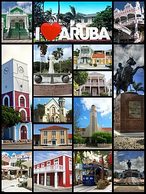
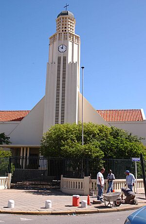
Clockwise: Townhall, I Love Aruba sign, Royal Plaza, Plaza Simon Bolivar, Plaza Betico Croes, Tram in center of the town, Census Building, Plaza Daniel Leo, Willem III tower.
Center clockwise: Wilhelmina Park, Archeological Museum, Ecury House, Protestant church, Aruban Courthouse, San Francisco church |
|
| Etymology: Orange Town | |
| Nickname(s):
Playa
|
|
| Motto(s):
One Happy Island
|
|
| Sovereign state | |
| Country | |
| Regions | Oranjestad West Oranjestad East |
| Founded | c. 1796 |
| Area | |
| • Total | 23 km2 (9 sq mi) |
| Elevation | 4 m (13 ft) |
| Population
(2020)
|
|
| • Total | 28,658 |
| • Rank | 1st |
| • Density | 2,522/km2 (6,530/sq mi) |
| Time zone | UTC-4 (AST) |
| Climate | BSh |
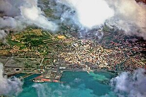
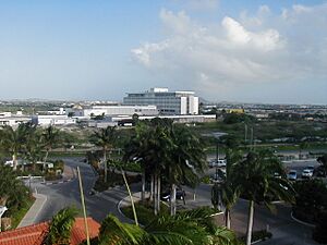
Oranjestad is the capital city of Aruba. It is also the largest city on the island. You can find it on the southwestern coast.
In Papiamento, which is the local language, people often call Oranjestad "Playa". The city is split into two main areas: Oranjestad East and Oranjestad West. In 2020, about 28,658 people lived here.
Contents
Discovering Oranjestad's Past
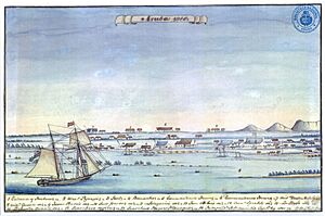
European settlers started small farms along Aruba's south coast around 1754. This led to the first towns growing in the area. By 1795 or 1796, Aruba became more open to trade. This helped the village by the bay, which is now Oranjestad, to grow.
Traders and craftspeople moved to this new village. The governor allowed them to settle and trade. They had to get their goods from Curaçao.
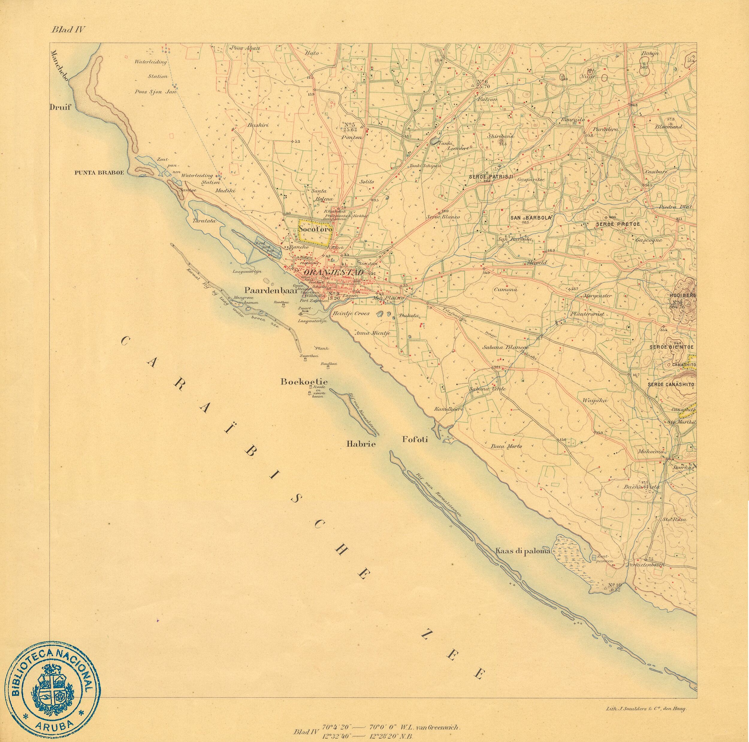
Jewish settlers also came to Aruba. They were good at trading and knew Spanish. They used their connections to trade with the mainland. They chose a place called Paardenbaai (which means "Bay of Horses") as their main trading spot. This bay was better for ships.
They sold local products like cattle, sheep, and gold. But mostly, they brought in goods from Curaçao. These goods were then traded along the Venezuelan coast. They imported food, clothes, and tools.
The village of Playa grew because of this trade. In 1798, a fort called Fort Zoutman was built. This was an important time for traders moving to Paardenbaai. The first Catholic church was built between 1800 and 1810. A Protestant teacher arrived in 1822.
Trade slowed down around 1822 because of a war in South America. But then, gold was found in 1824! This brought new life to Aruba. In 1824, the village was named Oranjestad. It was named after William I of the Netherlands.
Hoezee! Hoezee! Hoezee! Lang leve de Oranjestad! zij groeije en bloeije!
Hooray! Hooray! Hooray! Long live Oranjestad! May it grow and flourish!
In 1805, Paardenbaai had 32 houses. By 1824, it had 185 houses. In 1837, people said the village looked like "a heap of scattered houses." By 1860, about 1,000 people lived in Oranjestad. This was a big part of Aruba's population.
The Ranchoe area in Oranjestad-west was a special neighborhood. Many of the island's fishers lived there. There were also farms that grew plants for red dye.
When oil refineries like Lago Oil and Transport Company started around 1924, Oranjestad grew a lot. More people moved there, and the city became richer. Wealthier homes started to appear after the oil industry began.
Exploring Oranjestad's Geography
Oranjestad is built on old limestone from about 24 million years ago. Some parts of the city were even built by adding land into the sea. For example, the Renaissance Marketplace and Queen Wilhelmina Park are on this "reclaimed land." This means land was created where there used to be water.
There is also an important area for birds nearby. It's called the Important Bird Area MPA Oranjestad Reef Islands. It is next to the main harbor.
Regions and Zones of Oranjestad
Aruba has 8 main regions. Oranjestad is divided into two regions: Oranjestad West and Oranjestad East. Each of these has 8 smaller zones.
|
Oranjestad West
|
Oranjestad East
|
Oranjestad's Climate
Oranjestad has a hot, semi-dry climate. This means it's warm all year round. The air is humid, but it doesn't rain much. This is because of the way the winds blow in this region.
The short rainy season is from September to January. During these months, the winds change. This brings more moisture and a bit more rain.
| Climate data for Oranjestad, Aruba (normals 1991–2020, extremes 1951–2020) | |||||||||||||
|---|---|---|---|---|---|---|---|---|---|---|---|---|---|
| Month | Jan | Feb | Mar | Apr | May | Jun | Jul | Aug | Sep | Oct | Nov | Dec | Year |
| Record high °C (°F) | 32.5 (90.5) |
33.0 (91.4) |
33.9 (93.0) |
34.4 (93.9) |
34.9 (94.8) |
35.2 (95.4) |
35.3 (95.5) |
36.1 (97.0) |
36.5 (97.7) |
35.4 (95.7) |
35.0 (95.0) |
34.8 (94.6) |
36.5 (97.7) |
| Mean daily maximum °C (°F) | 30.3 (86.5) |
30.6 (87.1) |
31.1 (88.0) |
31.9 (89.4) |
32.4 (90.3) |
32.5 (90.5) |
32.4 (90.3) |
33.2 (91.8) |
33.2 (91.8) |
32.4 (90.3) |
31.5 (88.7) |
30.7 (87.3) |
31.8 (89.2) |
| Daily mean °C (°F) | 27.0 (80.6) |
27.1 (80.8) |
27.4 (81.3) |
28.2 (82.8) |
28.7 (83.7) |
29.0 (84.2) |
28.9 (84.0) |
29.5 (85.1) |
29.6 (85.3) |
29.1 (84.4) |
28.4 (83.1) |
27.5 (81.5) |
28.4 (83.1) |
| Mean daily minimum °C (°F) | 24.8 (76.6) |
24.8 (76.6) |
25.3 (77.5) |
26.0 (78.8) |
26.7 (80.1) |
26.9 (80.4) |
26.7 (80.1) |
27.2 (81.0) |
27.3 (81.1) |
26.7 (80.1) |
26.0 (78.8) |
25.3 (77.5) |
26.1 (79.0) |
| Record low °C (°F) | 19.0 (66.2) |
20.6 (69.1) |
21.2 (70.2) |
21.5 (70.7) |
21.8 (71.2) |
22.7 (72.9) |
21.2 (70.2) |
21.3 (70.3) |
22.1 (71.8) |
21.9 (71.4) |
22.0 (71.6) |
20.5 (68.9) |
19.0 (66.2) |
| Average rainfall mm (inches) | 44.0 (1.73) |
19.5 (0.77) |
10.0 (0.39) |
8.6 (0.34) |
14.1 (0.56) |
17.4 (0.69) |
19.6 (0.77) |
31.4 (1.24) |
42.9 (1.69) |
76.5 (3.01) |
87.1 (3.43) |
80.1 (3.15) |
451.1 (17.76) |
| Average rainy days (≥ 1.0 mm) | 10.8 | 4.5 | 2.0 | 1.5 | 1.7 | 2.8 | 4.1 | 3.1 | 3.3 | 7.3 | 9.6 | 11.0 | 61.7 |
| Average relative humidity (%) | 77.8 | 76.2 | 75.9 | 76.9 | 77.9 | 77.4 | 77.8 | 75.6 | 76.2 | 77.9 | 78.8 | 77.9 | 77.2 |
| Source: Departamento Meteorologico Aruba | |||||||||||||
Oranjestad's Culture and Fun
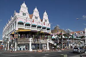
You can see some beautiful Dutch Colonial architecture in Oranjestad. The government is working to save old buildings. Many old houses and buildings in the city center have been painted in bright colors. They are now important landmarks, like the yellow-green City Hall.
Sports Teams in Oranjestad
Oranjestad is home to several football (soccer) teams. These include SV Dakota, SV Racing Club Aruba, and SV River Plate Aruba. All these teams play in Aruba's top football league, the Aruban Division di Honor.
Economy and Tourism in Oranjestad
Oranjestad has a busy economy, especially with tourism.
Shopping and Attractions
You can find modern shopping areas in Oranjestad. The Royal Plaza is an outdoor shopping mall. There are also shops along Main Street and in the Main Square.
Fort Zoutman is one of the city's main attractions. It was built in the late 1700s. It is the oldest building in Aruba. The fort is recognized by UNESCO as a place important to the history of the slave trade. Other cool places to visit include the tax-free harbor and the Willem III Tower, which is near the fort.
Aruba also has about eight museums to explore.
Renaissance Island: A Private Paradise
Renaissance Island is a special place near Oranjestad. It's a private island, also known as Bucuti Rif. It has the only private beaches in Aruba: Iguana Beach and Flamingo Beach.
Two old planes were sunk near the island on purpose. This created a cool spot for diving. You can see Flamingoes on the island, but they are not originally from Aruba.
Getting Around Oranjestad
Oranjestad is close to the Queen Beatrix International Airport. The airport is only about 2.5 kilometers (1.5 miles) from the city center. There is also a tramway line that serves the downtown area.
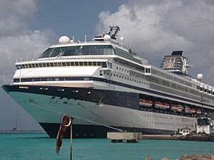
Caya G. F. Betico Croes, or Main Street, used to be the main shopping area. But now, many shoppers prefer Lloyd G. Smith Boulevard. This street is closer to where cruise ships dock.
Paardenbaai is the biggest port for passengers. It can hold up to five ships. There is another port for cargo ships called Barcadera, about 5 kilometers (3 miles) east. Plans are being made to make the port in Oranjestad even better. They want to build a marina for yachts and fishing boats.
Learning in Oranjestad
Oranjestad is home to the University of Aruba. This university offers programs in law and economics. The city also has the island's largest high school, Colegio Arubano. Both schools follow the Dutch education system. Many students from Aruba go on to study at universities in the Netherlands.
Famous People from Oranjestad
- Dave Benton, who won the Eurovision Song Contest 2001 for Estonia.
- Xander Bogaerts, a baseball player who has won the World Series twice.
- Bobby Farrell, a singer from the group Boney M.
- Vince Irie, a singer-songwriter.
- Chadwick Tromp, a baseball player for the Atlanta Braves.
See also
 In Spanish: Oranjestad (Aruba) para niños
 | Calvin Brent |
 | Walter T. Bailey |
 | Martha Cassell Thompson |
 | Alberta Jeannette Cassell |


