
Image: Hadspen tasmania map

Size of this preview: 800 × 594 pixels. Other resolutions: 320 × 238 pixels | 1,024 × 760 pixels.
Original image (1,024 × 760 pixels, file size: 52 KB, MIME type: image/png)
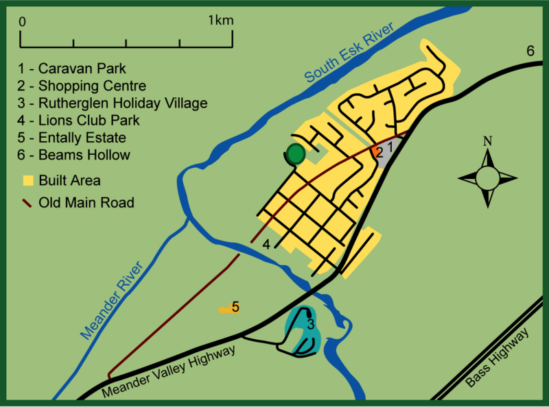
Description: Map of Hadspen, Tasmania. Based loosly on an aerial map (from page 6 of the October 2011 HADSPEN OUTLINE DEVELOPMENT PLAN - http://www.meander.tas.gov.au/webdata/resources/files/FINAL_Hadspen_ODP_30_9_11.pdf), local street directory and some creative licence in terms of the exact boundary of the built area and river's path.
Title: Hadspen tasmania map
Credit: Own work
Author: Peripitus
Usage Terms: Creative Commons Attribution 3.0
License: CC BY 3.0
License Link: http://creativecommons.org/licenses/by/3.0
Attribution Required?: Yes
Image usage
The following page links to this image:

All content from Kiddle encyclopedia articles (including the article images and facts) can be freely used under Attribution-ShareAlike license, unless stated otherwise.