
Image: Haiti and Santo Domingo inset map (1921)
Size of this preview: 800 × 373 pixels. Other resolutions: 320 × 149 pixels | 1,164 × 543 pixels.
Original image (1,164 × 543 pixels, file size: 272 KB, MIME type: image/jpeg)
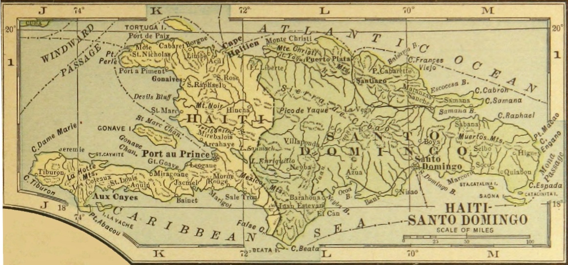
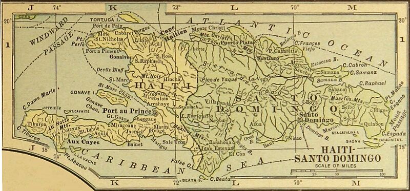
Description: Map of Hispaniola (Haiti and Santo Domingo) from Putnam's Handy Volume Atlas of the World... (G. P. Putnam's Sons, 1921) p. 115 (inset). Scanned by University of Michigan and copied from HathiTrust’s digital library (http://catalog.hathitrust.org/Record/001877419)
Title: Haiti and Santo Domingo inset map (1921)
Credit: Hathi Trust Digital Library
Author: G.P. Putnam's Sons
Usage Terms: Public domain
License: Public domain
Attribution Required?: No
Image usage
The following page links to this image:

All content from Kiddle encyclopedia articles (including the article images and facts) can be freely used under Attribution-ShareAlike license, unless stated otherwise.
.jpg)