
Image: Harness Ireland Railroad Map 1838
Size of this preview: 477 × 600 pixels. Other resolutions: 191 × 240 pixels | 2,000 × 2,514 pixels.
Original image (2,000 × 2,514 pixels, file size: 7.59 MB, MIME type: image/png)
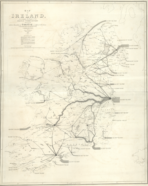
Description: A map of railroad traffic in Ireland, created by Henry Drury Harness in 1838. This map is often credited as one of the first flow maps and one of the first proportional symbol maps
Usage Terms: Public domain
Image usage
The following page links to this image:

All content from Kiddle encyclopedia articles (including the article images and facts) can be freely used under Attribution-ShareAlike license, unless stated otherwise.