
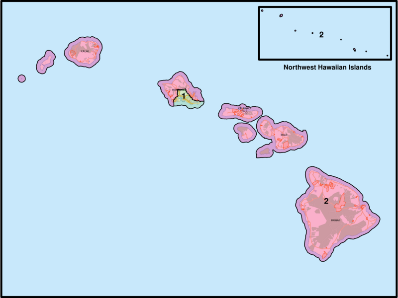
Image: Hawaii Congressional Districts, 118th Congress

Description: Map of the congressional districts of Hawaii, complemented with county boundaries as well as major roads, water areas, urban areas, forest reserves, and Hawaiian home lands in Hawaii. The map includes an inset for the Northwest Hawaiian Islands. These congressional districts are put into effect from 2023, following the 2022 US House elections. Shapefiles from the United States Census Bureau and the State of Hawaii Office of Planning and Sustainable Development, converted with Mapshaper (Mercator projection).
Title: Hawaii Congressional Districts, 118th Congress
Credit: Own work
Author: Twotwofourtysix
Usage Terms: Creative Commons Attribution-Share Alike 4.0
License: CC BY-SA 4.0
License Link: https://creativecommons.org/licenses/by-sa/4.0
Attribution Required?: Yes
Image usage
The following page links to this image:
