
Image: Hawkesworth-Byron-Map
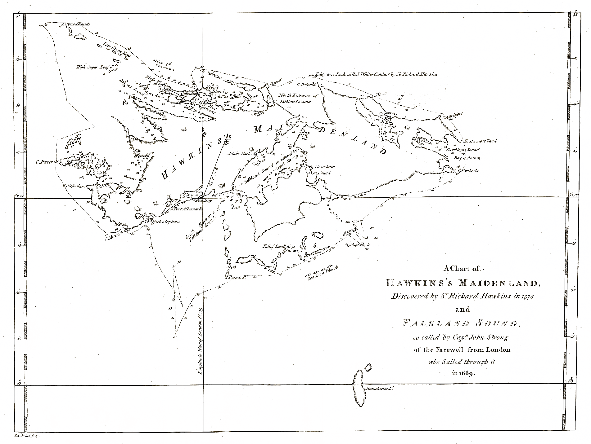
Description: Chart by John MacBride from his 1766 hydrographic survey of the Falkland Islands, published in 1773 by John Hawkesworth and John Byron.
Title: Hawkesworth-Byron-Map
Credit: A chart of Hawkins’s Maidenland, discovered by Sr. Richard Hawkins in 1574 and Falkland Sound, so called by Capn. John Strong of the Farewell from London who sailed through it in 1689. Scale 1:1000000. In: An account of the voyages undertaken by the order of His present Majesty for making discoveries in the Southern Hemisphere. Eds. J. Hawkesworth and J. Byron. Vol. I. London: W. Strahan and T. Cadell, 1773 (following p. 40)
Author: John MacBride, published by J. Hawkesworth and J. Byron
Permission: Public domain because of age
Usage Terms: Public domain
License: Public domain
Attribution Required?: No
Image usage
The following page links to this image:
