
Image: Heijokyo - Map of major buildings
Size of this preview: 712 × 600 pixels. Other resolutions: 285 × 240 pixels | 906 × 763 pixels.
Original image (906 × 763 pixels, file size: 46 KB, MIME type: image/png)
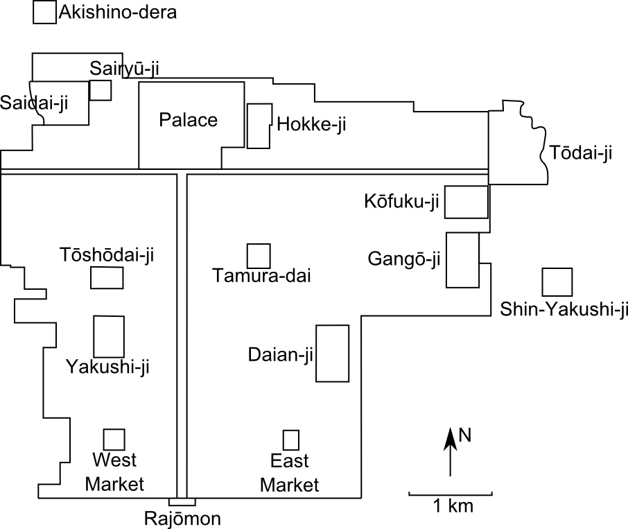
Description: Map of the major buildings of Heijokyo at the end of the 8th century. Source: Tanaka Migaku, Heijō-kyō, Iwanami shoten, 1984, p. 4.
Title: Heijokyo - Map of major buildings
Credit: Own work
Author: Binabik155
Usage Terms: Creative Commons Attribution 3.0
License: CC BY 3.0
License Link: http://creativecommons.org/licenses/by/3.0
Attribution Required?: Yes
Image usage
The following page links to this image:

All content from Kiddle encyclopedia articles (including the article images and facts) can be freely used under Attribution-ShareAlike license, unless stated otherwise.