
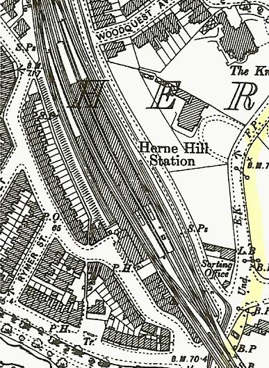
Image: Herne Hill railway OS Map 1894
No higher resolution available.
Herne_Hill_railway_OS_Map_1894.jpg (387 × 530 pixels, file size: 99 KB, MIME type: image/jpeg)
Description: Herne Hill railway station as seen in the 1894 Ordnance Survey.
Title: Herne Hill railway OS Map 1894
Credit: Ordnance Survey - Scanned from original 1894 map of Lambeth
Author: Ordnance Survey
Usage Terms: Public domain
License: Public domain
Attribution Required?: No
Image usage
The following page links to this image:

All content from Kiddle encyclopedia articles (including the article images and facts) can be freely used under Attribution-ShareAlike license, unless stated otherwise.