
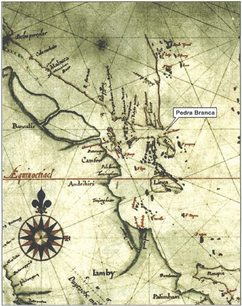
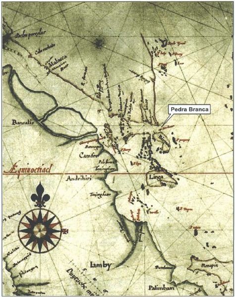
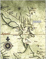
Image: Hessel Gerritsz, Map of Sumatra showing Pedra Branca (1620)
Description: Detail of a "Map of Sumatra" showing the island of "Pedrablanca" (Pedra Branca) by Hessel Gerritz, a cartographer of the Hydrographic Service of the Dutch East India Company: see Case Concerning Sovereignty over Pedra Branca/Pulau Batu Puteh, Middle Rocks and South Ledge (Malaysia/Singapore): Memorial of Malaysia, vol. 1, p. 137, para. 306.
Title: Hessel Gerritsz, Map of Sumatra showing Pedra Branca (1620)
Credit: Reproduced as insert 23 of (25 March 2004) Case Concerning Sovereignty over Pedra Branca/Pulau Batu Puteh, Middle Rocks and South Ledge (Malaysia/Singapore): Memorial of Malaysia, volume 1, Government of Malaysia (reproduced on the International Court of Justice website), pp. 136 Retrieved on 28 September 2008.
Author: Hessel Gerritsz
Usage Terms: Public domain
License: Public domain
Attribution Required?: No
Image usage
The following page links to this image:

.jpg)