
Image: Hingham Bay Massachusetts

Size of this PNG preview of this SVG file: 800 × 587 pixels. Other resolution: 320 × 235 pixels.
Original image (SVG file, nominally 1,600 × 1,174 pixels, file size: 1.37 MB)
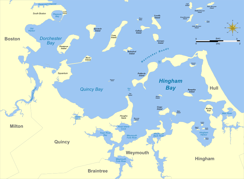
Description: Map of southern part of Boston Harbor showing Hingham Bay and nearby features.
Title: Hingham Bay Massachusetts
Credit: self-made using Quantum GIS and Inkscape based on public data from Office of Geographic and Environmental Information (MassGIS), Commonwealth of Massachusetts Executive Office of Environmental Affairs - http://www.mass.gov/mgis/dd-over.htm
Author: Sswonk
Usage Terms: Creative Commons Attribution-Share Alike 3.0
License: CC BY-SA 3.0
License Link: https://creativecommons.org/licenses/by-sa/3.0
Attribution Required?: Yes
Image usage
The following page links to this image:

All content from Kiddle encyclopedia articles (including the article images and facts) can be freely used under Attribution-ShareAlike license, unless stated otherwise.