
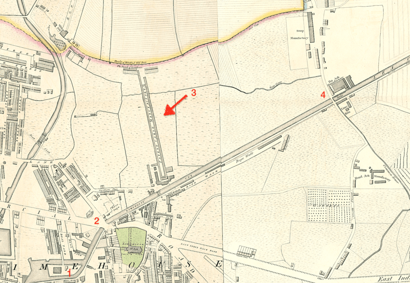
Image: Horwood's 1819 map showing the Limehouse Cut, London

Size of this preview: 800 × 551 pixels. Other resolutions: 320 × 220 pixels | 1,839 × 1,266 pixels.
Original image (1,839 × 1,266 pixels, file size: 5.17 MB, MIME type: image/png)
Description: 1. The Island. 2. Britannia Bridge. 3. Huddart's Patent Cable Works. 4. Stinkhouse Bridge.
Title: Horwood's 1819 map showing the Limehouse Cut, London
Credit: Horwood & Faden (1819), "Plan of the Cities of London and Westminster"
Author: Richard Horwood and William Fadden
Usage Terms: Public domain
License: Public domain
Attribution Required?: No
Image usage
The following page links to this image:

All content from Kiddle encyclopedia articles (including the article images and facts) can be freely used under Attribution-ShareAlike license, unless stated otherwise.