
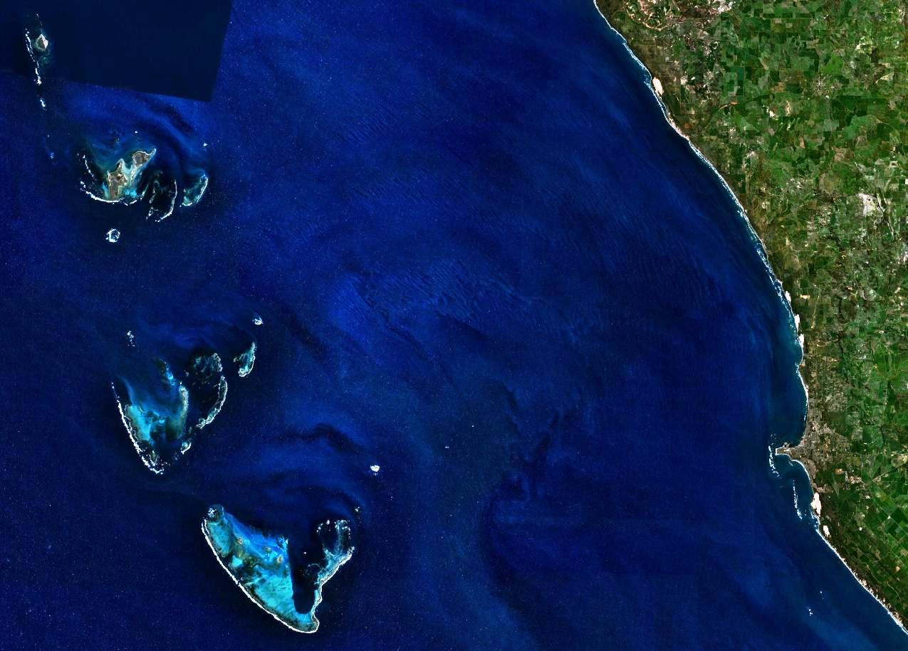
Image: Houtman Abrolhos and adjacent coast
Description: This is a satellite image of the Houtman Abrolhos and the adjacent coast of Western Australia. The point in the lower right quadrant is Point Moore, the location of the city of Geraldton, Western Australia.
Title: Houtman Abrolhos and adjacent coast
Credit: It was made with NASA World Wind using Landsat 7 data.
Author: It was created by Hesperian. Any IP involved in the creation of this image is released into the public domain.
Permission: Public domainPublic domainfalsefalse This image is in the public domain because it is a screenshot from NASA’s globe software World Wind using a public domain layer, such as Blue Marble, MODIS, Landsat, SRTM, USGS or GLOBE. العربيَّة | English | فارسی | français | עברית | македонски | മലയാളം | Nederlands | русский | 中文(中国大陆) | +/−
Usage Terms: Public domain
License: Public domain
Attribution Required?: No
Image usage
The following page links to this image:
