
Image: Hurricane Dora 1964 Florida track
Size of this preview: 758 × 600 pixels. Other resolutions: 303 × 240 pixels | 2,599 × 2,057 pixels.
Original image (2,599 × 2,057 pixels, file size: 1.33 MB, MIME type: image/png)
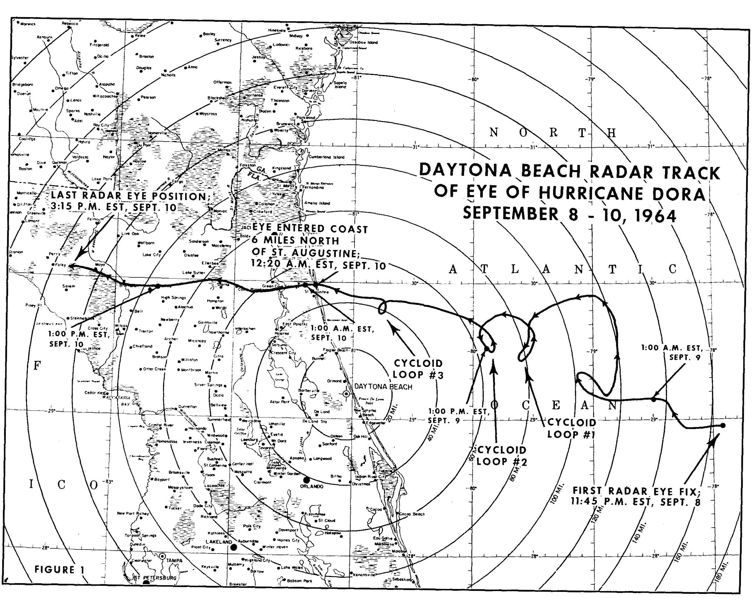
Description: Enlarged track of Hurricane Dora (1964) as it approached the northeastern coast of Florida. The center was determined by the Weather Bureau radar in Daytona Beach and detailed three distinct cyclonic loops before the storm moved ashore.
Title: Hurricane Dora 1964 Florida track
Credit: http://docs.lib.noaa.gov/rescue/hurricanes/Qc9452d673h81964.pdf
Author: United States Weather Bureau
Usage Terms: Public domain
License: Public domain
Attribution Required?: No
Image usage
The following 2 pages link to this image:

All content from Kiddle encyclopedia articles (including the article images and facts) can be freely used under Attribution-ShareAlike license, unless stated otherwise.