
Image: Hurricane Paula 2010-10-12 1620Z
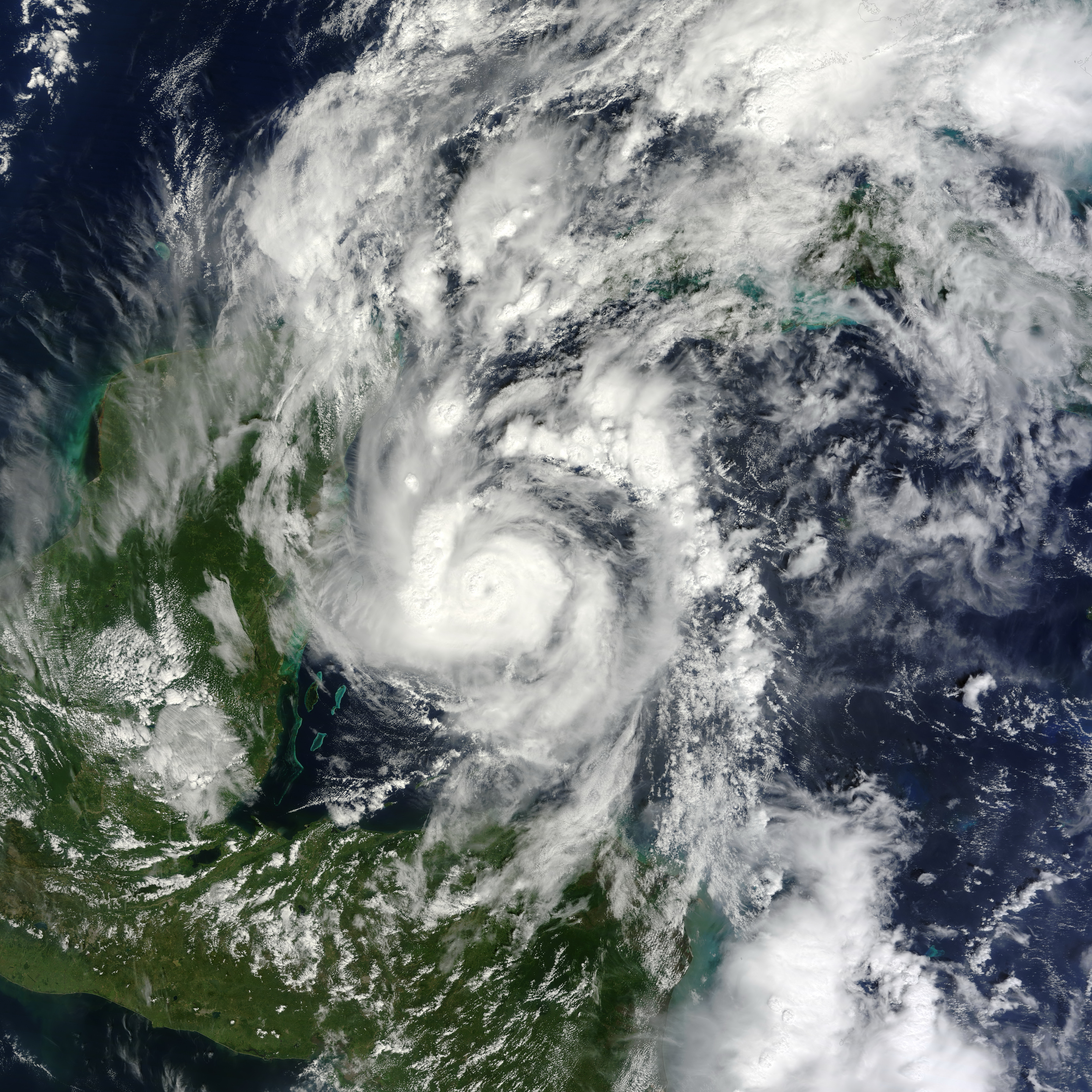
Description: Small but powerful, Hurricane Paula packed winds of 100 miles (160 kilometers) per hour on October 12, 2010. At 12:45 p.m. Central Daylight Time (CDT), the U.S. National Hurricane Center (NHC) reported that Paula was a Category 2 hurricane, located roughly 140 miles (220 kilometers) south-southeast of Cozumel, Mexico, and was traveling slowly toward the north-northwest. The Moderate Resolution Imaging Spectroradiometer (MODIS) on NASA’s Terra satellite captured this natural-color image of Hurricane Paula at 11:20 a.m. CDT (16:20 UTC) on October 12 while over the Caribbean Sea, just off the coasts of Mexico, Belize, and Honduras. Coiled around a distinct eye, the storm’s most intense clouds spanned roughly 200 kilometers (125 miles). By October 14, 2010, Paula had weakened to a tropical storm. At 10:00 a.m. CDT on October 14, the NHC reported that Paula had winds of 70 miles (110 kilometers) per hour. Though less intense than it had been two days earlier, Paula still posed hazards. A tropical storm warning was in effect for parts of Cuba, and a tropical storm watch was in effect for parts of the Florida Keys. The NHC warned of high winds and heavy rains—amounting to 10 inches (25 centimeters) in isolated areas.
Title: Hurricane Paula 2010-10-12 1620Z
Credit: [1]
Author: NASA image by Jeff Schmaltz, MODIS Rapid Response Team at NASA GSFC. Caption by Michon Scott.
Usage Terms: Public domain
License: Public domain
Attribution Required?: No
Image usage
The following page links to this image:
