
Image: IleAuxNoix1760

Size of this preview: 800 × 492 pixels. Other resolutions: 320 × 197 pixels | 2,190 × 1,347 pixels.
Original image (2,190 × 1,347 pixels, file size: 534 KB, MIME type: image/jpeg)
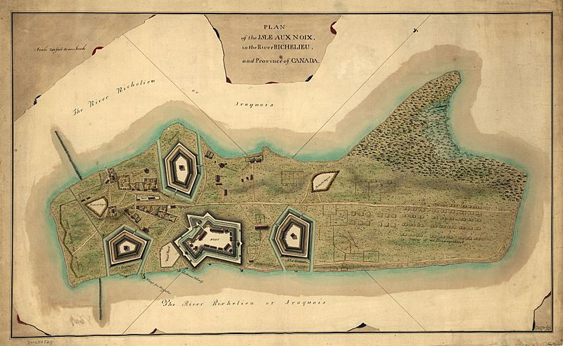
Description: This is a map of fortifications on the Ile aux Noix, circa 1760. Caption reads: Plan of the Isle aux Noix, in the River Richelieu, and Province of Canada. [Signed:] T. Walker, Capt., 60th regt. delt.
Title: IleAuxNoix1760
Credit: This map is available from the United States Library of Congress's Geography & Map Division under the digital ID g3452i.ar062000. This tag does not indicate the copyright status of the attached work. A normal copyright tag is still required. See Commons:Licensing for more information.
Author: Thomas Walker
Usage Terms: Public domain
License: Public domain
Attribution Required?: No
Image usage
The following 4 pages link to this image:

All content from Kiddle encyclopedia articles (including the article images and facts) can be freely used under Attribution-ShareAlike license, unless stated otherwise.