
Image: Ile brion island-map
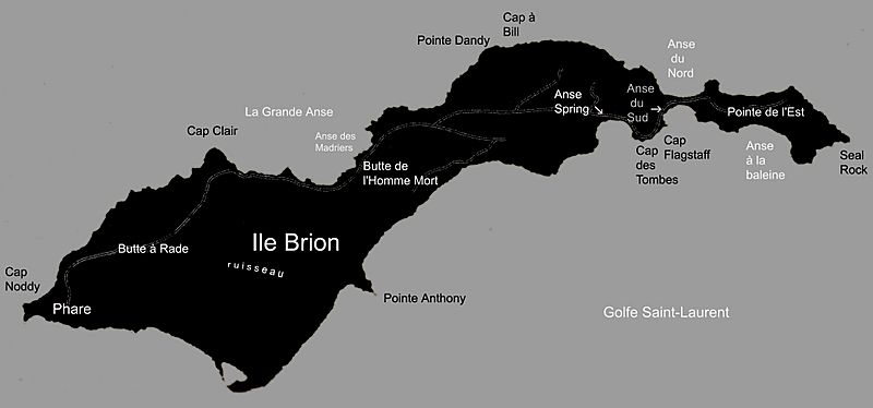
Size of this preview: 800 × 374 pixels. Other resolutions: 320 × 149 pixels | 2,163 × 1,010 pixels.
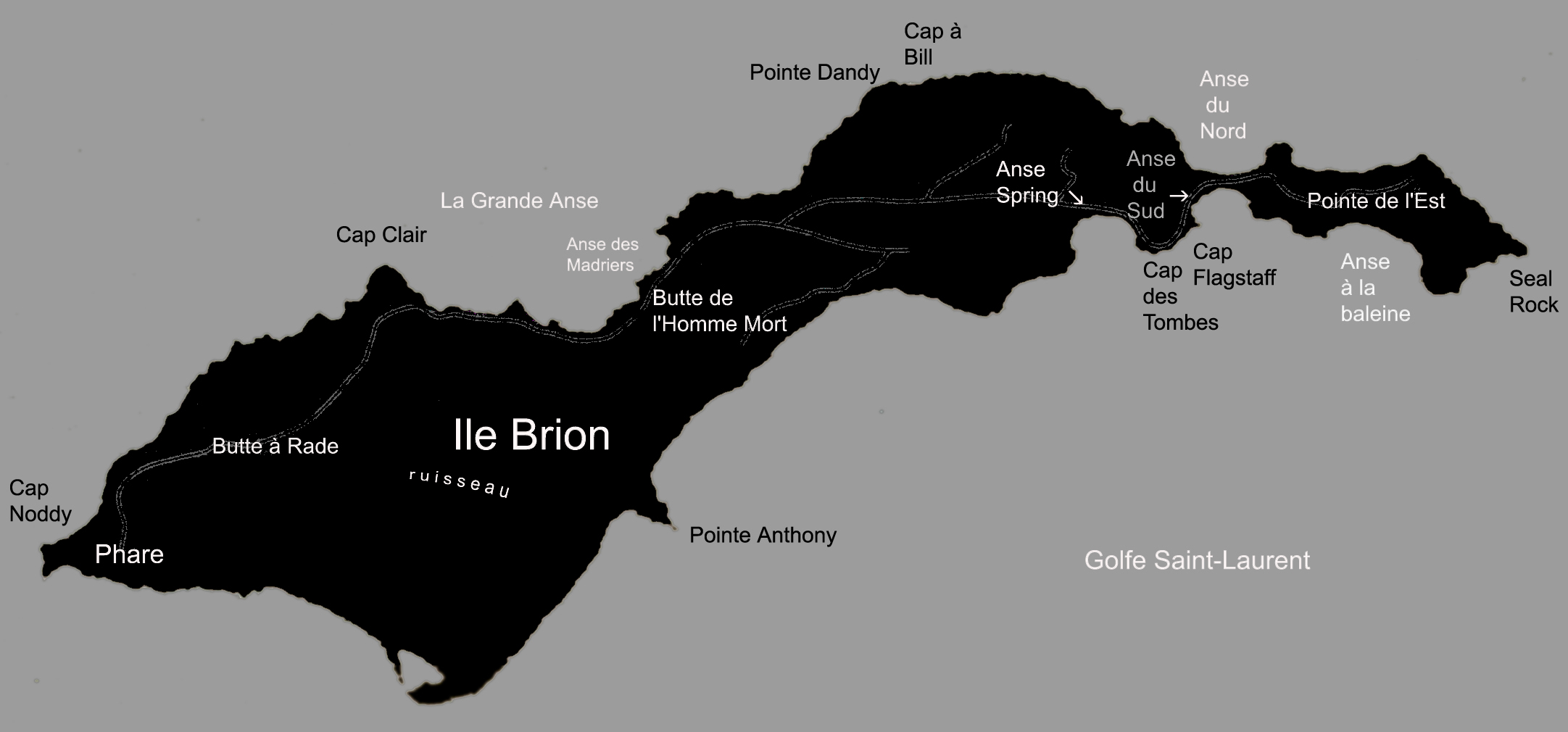
Original image (2,163 × 1,010 pixels, file size: 229 KB, MIME type: image/jpeg)
Description: Carte en noir et blanc de l'île Brion
Title: Ile brion island-map
Credit: Inspirée par la carte des îles-de-la-Madeleine mise en jour en 1989 et publiée par Les Publications du Québec en 1992.
Author: Matthieu Godbout
Usage Terms: Creative Commons Attribution-Share Alike 3.0
License: CC-BY-SA-3.0
License Link: http://creativecommons.org/licenses/by-sa/3.0/
Attribution Required?: Yes
Image usage
The following page links to this image:

All content from Kiddle encyclopedia articles (including the article images and facts) can be freely used under Attribution-ShareAlike license, unless stated otherwise.