
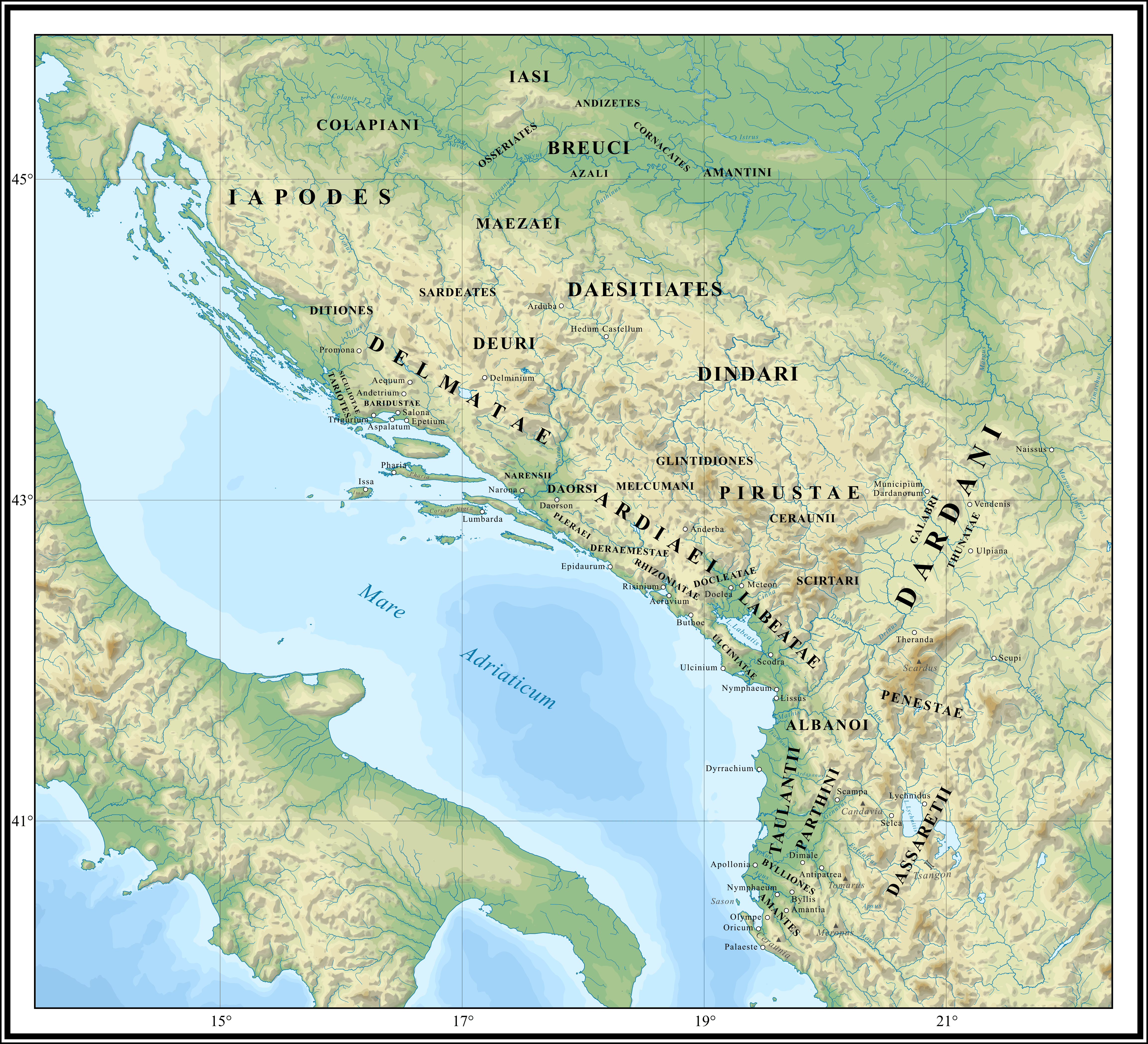
Image: Illyrians in the 1st-2nd centuries CE
Description: Map depicting Illyrian tribes in the 1st-2nd centuries CE.
Title: Illyrians in the 1st-2nd centuries CE
Credit: Own work, based on following sources: Eichner, Heiner (2004) "Illyrisch – die unbekannte Sprache" in Eichner, Heiner , ed. (in German) Die Illyrer. Archäologische Funde des 1. Vorchristlichen Jahrtausends aus Albanien, Museum für Urgeschichte Asparn an der Zaya ISBN: 3-85460-215-4. Matijašić, Ivan (2011). ""Shrieking like Illyrians": Historical geography and the Greek perspective of the Illyrian world in the 5th century BC". Arheološki Vestnik 62. Research Centre of the Slovenian Academy of Sciences and Arts. Prifti, Kristaq (2002) Instituti i Historisë (Akademia e Shkencave e RSH) , ed. (in Albanian) Historia e popullit shqiptar, Historia e popullit shqiptar në katër vëllime, 1, Botimet Toena ISBN: 9789992716229. Šašel Kos, Marjeta (2013). "The 'great lake' and the Autariatai in Pseudo-Skylax". Mélanges de l'École française de Rome: Antiquité 125 (1). DOI:10.4000/mefra.1376. Wilkes, J. J. (1996) "The Danubian and Balkan provinces" in The Cambridge Ancient History: The Augustan Empire, 43 B.C—A.D. 69, 10, Cambridge University Press ISBN: 0521264308. Topography taken from the vectorial map of the Balkans, made by Ikonast. File:Geographic_map_of_Balkan_Peninsula.svg
Author: Ahmet Q.
Usage Terms: Creative Commons Attribution-Share Alike 4.0
License: CC BY-SA 4.0
License Link: https://creativecommons.org/licenses/by-sa/4.0
Attribution Required?: Yes
Image usage
The following page links to this image:
