
Image: IncaChileespañol1.0
Size of this preview: 289 × 599 pixels. Other resolutions: 116 × 240 pixels | 741 × 1,536 pixels.
Original image (741 × 1,536 pixels, file size: 466 KB, MIME type: image/png)
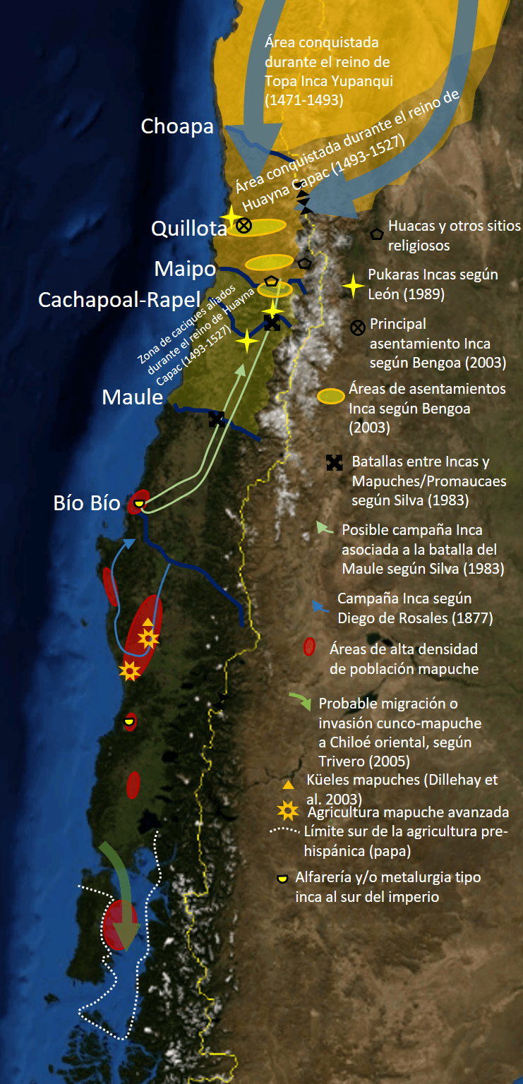
Description: Compilación cartográfica de información sobre la expansión e influencia del Imperio inca en Chile central y centro-sur hasta Chiloé. Algunos datos son especulativos pero siempre basado en fuentes. Se incluye también la penetración cunco-mapuche de Chiloé que podría haber ocurrido en el periodo pre-hipánico tardío.
Title: IncaChileespañol1.0
Credit: Own work
Author: Sietecolores
Usage Terms: Creative Commons Attribution-Share Alike 4.0
License: CC BY-SA 4.0
License Link: https://creativecommons.org/licenses/by-sa/4.0
Attribution Required?: Yes
Image usage
The following page links to this image:

All content from Kiddle encyclopedia articles (including the article images and facts) can be freely used under Attribution-ShareAlike license, unless stated otherwise.