
Image: India Karnataka location map

Size of this preview: 421 × 599 pixels. Other resolutions: 169 × 240 pixels | 851 × 1,211 pixels.
Original image (851 × 1,211 pixels, file size: 109 KB, MIME type: image/png)
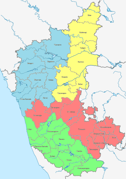
Description: Divisions - Bengaluru Division (Red), Mysuru Division (Green), Kitturu Karnataka Division (Blue) and Kalyana Karnataka Division (Yellow) along with the 31 districts of Karnataka.
Title: India Karnataka location map
Credit: Own work
Author: Lokeshwaran Vela Rajan
Usage Terms: Creative Commons Attribution-Share Alike 4.0
License: CC BY-SA 4.0
License Link: https://creativecommons.org/licenses/by-sa/4.0
Attribution Required?: Yes
Image usage
The following 2 pages link to this image:

All content from Kiddle encyclopedia articles (including the article images and facts) can be freely used under Attribution-ShareAlike license, unless stated otherwise.