
Image: India roadway map with population density

Size of this PNG preview of this SVG file: 530 × 599 pixels. Other resolution: 212 × 240 pixels.
Original image (SVG file, nominally 1,639 × 1,852 pixels, file size: 1.4 MB)
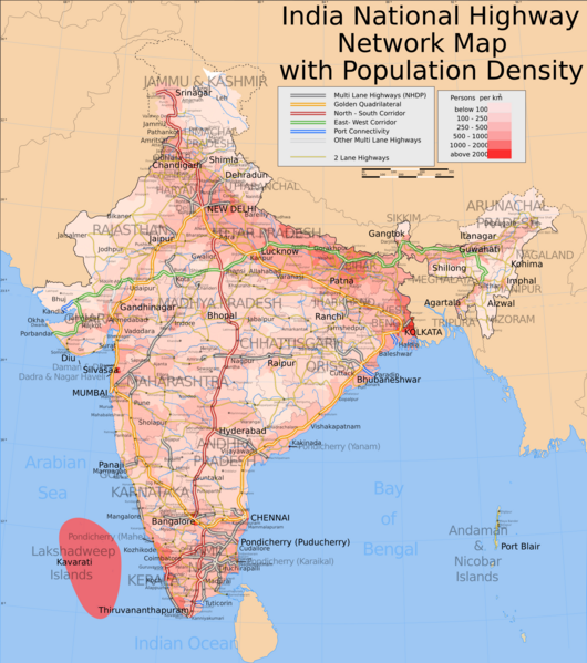
Description: Map showing the national highway network in India and population density of each districts. Includes w:NHDP projects upto phase IIIA which is due to be completed by December 2009. For actual progress of the NHDP refer to the maps below.
Author: w:user:Planemad
Usage Terms: Creative Commons Attribution-Share Alike 3.0
License: CC-BY-SA-3.0
License Link: http://creativecommons.org/licenses/by-sa/3.0/
Attribution Required?: Yes
Image usage
The following page links to this image:

All content from Kiddle encyclopedia articles (including the article images and facts) can be freely used under Attribution-ShareAlike license, unless stated otherwise.