Deccan Plateau facts for kids
Quick facts for kids
Deccan Plateau
Deccan Peninsula
|
|
|---|---|
|
Geographical region
|
|
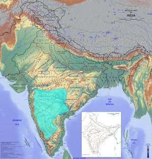
The Deccan Plateau (cyan) forms a major part of Peninsular India
|
|
| Country | India |
| States | |
| Area | |
| • Total | 422,000 km2 (163,000 sq mi) |
The Deccan Plateau is a huge, flat area of land that covers most of the Indian peninsula. Imagine a giant, slightly tilted tableland in the middle of India – that's the Deccan! It stretches over an area of about 422,000 square kilometers (that's a lot of land!) and is surrounded by mountains on its sides.
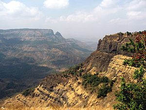
To the north, you'll find the Satpura Range and Vindhya Range. On the west, there are the Western Ghats, and on the east, the Eastern Ghats. These mountain ranges separate the plateau from the flat coastal areas. The Deccan Plateau covers most of the Indian states of Maharashtra, Karnataka, Telangana, and Andhra Pradesh, and also small parts of Tamil Nadu and Kerala.
The land here is mostly rocky, with an average height of about 600 meters (around 2,000 feet). It's divided into different parts, like the Maharashtra Plateau and the Karnataka Plateau. The Deccan is super old, and its rocks tell an amazing story of ancient volcanoes!
Contents
- What is the Deccan Plateau?
- The Name: Where did "Deccan" come from?
- A Journey Through Time: History of the Deccan Plateau
- The Earth's Story: Geology of the Deccan Plateau
- Water and Weather: Hydrography and Climate
- Nature's Bounty: Flora and Fauna
- People and Culture: Life in the Deccan
- Getting Around: Transport in the Deccan
- See also
What is the Deccan Plateau?
The Deccan Plateau is a large, raised area of land, like a tabletop, that makes up a big part of southern India. It's one of the oldest and most stable land formations in the entire Indian subcontinent.
Where is the Deccan Plateau located?
The Deccan Plateau is shaped a bit like an upside-down triangle. Its top part is near the Narmada River basin, close to the Vindhya and Satpura mountain ranges. The bottom tip reaches down to the northern edges of Tamil Nadu in the south.
It's bordered by two important mountain ranges:
- The Western Ghats on the west side.
- The Eastern Ghats on the east side.
These mountains create a natural boundary, separating the plateau from the flat coastal plains along India's shores. The plateau covers large parts of Maharashtra, Telangana, Karnataka, and Andhra Pradesh, and smaller areas of Tamil Nadu and Kerala.
How big is the Deccan Plateau?
The Deccan Plateau is huge! It covers an area of about 422,000 square kilometers (that's 163,000 square miles). To give you an idea, that's bigger than many countries!
The Name: Where did "Deccan" come from?
The word Deccan comes from an old Indian language called Prakrit. The word was dakkhaṇa, which itself came from the Sanskrit word dakṣiṇa. Both these words simply mean "south". So, the Deccan Plateau is essentially the "Southern Plateau" of India!
A Journey Through Time: History of the Deccan Plateau
The Deccan Plateau has a very long and rich history, going back thousands of years. People have lived here for a very, very long time!
Ancient Times: Early Settlements and Trade
Scientists have found evidence that people lived in the Deccan Plateau as far back as 8,000 BCE (that's 10,000 years ago!). They've found ancient ash mounds from the Neolithic period (New Stone Age). Around 1,000 BCE, people in the region started using iron technology.
From at least the 1st century BCE, the Deccan was an important part of ancient trade routes, connecting with places as far away as the Mediterranean and East Asia. It was like a busy highway for goods and ideas!
Kingdoms and Empires: Who Ruled the Deccan?
Over many centuries, different powerful kingdoms and empires ruled over parts of the Deccan Plateau. Some of the most famous ones include:
- The Satavahanas
- The Chalukyas
- The Rashtrakutas
- The Hoysalas
- The Kakatiyas
- The Pallavas, Cholas, and Pandyas (who mostly ruled the southern parts)
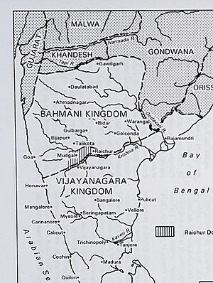
In the later Middle Ages, a mighty empire called the Vijayanagara empire controlled much of the southern plateau. The northern part was ruled by the Bahmani kingdom and then by its successor states, known as the Deccan sultanates.
European Influence and British Rule
In the 15th century CE, European traders started arriving in India. By the 18th century, the French and the British were fighting for control over different parts of India, including the Deccan.
The Maratha Empire, founded by the famous Chatrapati Shivaji, also briefly controlled parts of the region in the early 18th century. However, by the late 18th and early 19th centuries, the British East India Company had gained strong control. Later, in 1857, the British Empire took direct control, and the Deccan remained under British colonial rule for nearly a century.
Independent India: States Reorganized
After India gained independence in 1947, the states in the Deccan region were reorganized. In the 1950s, the States Reorganisation Act created new states based on the languages people spoke. This led to the formation of states like Andhra Pradesh, Karnataka, Kerala, Maharashtra, and Tamil Nadu. More recently, in 2014, Telangana was created by dividing Andhra Pradesh.
The Earth's Story: Geology of the Deccan Plateau
The Deccan Plateau is like a giant history book written in rocks! It's one of the oldest and most stable land formations in India.
The Deccan Traps: Ancient Volcanoes
One of the most amazing geological features here are the Deccan Traps. These are huge layers of igneous rocks (rocks formed from cooled lava) that are more than 2 kilometers (1.2 miles) thick in some places!
These rocks were formed by massive lava flows that came from deep inside the Earth's crust. This incredible volcanic event happened at the end of the Cretaceous period, about 66 million years ago. It was one of the largest volcanic eruptions ever recorded on land!
Scientists believe this eruption released enormous amounts of ash, dust, and carbon dioxide into the atmosphere. This would have blocked sunlight, causing temperatures to drop and leading to major climate changes on Earth. Some researchers even think this volcanic event contributed to the extinction of many species, including some of the dinosaurs!
Rocks and Minerals: Treasures of the Deccan
Underneath these lava deposits, you'll find even older rocks like granite and sedimentary rocks that formed during the Precambrian era, when the ancient supercontinent Gondwana was forming.
The Deccan Plateau is rich in valuable mineral deposits. You can find iron ore, coal, and mica here. There are also precious and semi precious stones that have been mined for centuries. In the 21st century, large uranium deposits have also been discovered.
The plateau has two main types of soil:
- Black soil: Found in areas with igneous basaltic rock. This soil is great for farming because it has a lot of clay, holds moisture well, and resists erosion.
- Red soil: Found in areas with less rainfall, especially near the Eastern Ghats. This soil is usually less fertile.
Water and Weather: Hydrography and Climate
The Deccan Plateau plays a crucial role in India's water systems and experiences a unique climate.
Rivers of the Deccan
The Deccan is one of India's major watersheds, meaning many important rivers start here or flow through it. The biggest rivers that begin in the Western Ghats and flow across the plateau are:
Most of these rivers flow eastwards towards the Bay of Bengal. This is because the plateau gently slopes from west to east. These rivers create many beautiful waterfalls and are often dammed to provide hydroelectric power and water for irrigation (watering crops).
Climate: Monsoon and Rain Shadow
The northern parts of the Deccan have a semi-arid climate (meaning it's quite dry), while most other areas have a tropical climate.
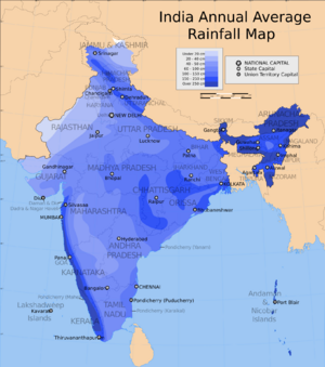
During the hot summer months (April-May), the interior of the Deccan Plateau gets very warm. This heat pulls in moist air from the Arabian Sea. However, when this moisture-filled air hits the tall Western Ghats, it's forced to rise. As it rises, it cools and drops most of its rain on the western coast. This is why the western coast gets a lot of rain during the monsoon season (June to September).
By the time the air crosses the Western Ghats, it has lost most of its moisture. This creates a "rain shadow" region on the leeward (eastern) side of the mountains, which is the interior of the Deccan Plateau. This means the plateau itself receives much less rainfall than the coastal areas. Some rain does come from monsoon winds that round the peninsula and move from the east (from the Bay of Bengal), bringing some rainfall to the eastern part of the plateau.
Nature's Bounty: Flora and Fauna
The Deccan Plateau is home to a wide variety of plants and animals, thanks to its different climates and landscapes.
Forests and Trees
In the drier, low-rainfall areas, you'll find thorn scrub forests. In the southern parts of the plateau, there are dry deciduous forests, where trees lose their leaves during the dry season.
The woodlands in the central part of the plateau are very old, even older than the Himalayas! Common trees here include teak, hardwickia, and various types of acacia.
Wildlife
The Deccan Plateau is a habitat for many fascinating animals. It's home to important populations of endangered Bengal tigers and Indian elephants. Other amazing mammals you might find here include:
- Gaur (Indian bison)
- Blackbuck
- Chinkara (Indian gazelle)
- Four-horned antelope
- Wild water buffalo
- Indian wild dog (Dhole)
People and Culture: Life in the Deccan
The Deccan Plateau is a vibrant region with diverse people, languages, and rich cultural traditions.
Languages and Demographics
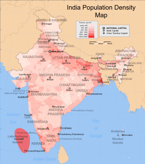
Many different languages are spoken in the Deccan. The largest group of languages belongs to the Dravidian family of languages, which includes Telugu (spoken by Telugus) and Kannada (spoken by Kannadigas) in the central region. Tamils and Malayalis live in the southern parts of the plateau.
In the north-western part, most people speak Marathi, which is an Indo-Aryan language. English is also widely spoken in cities. A regional dialect of Urdu called Deccani Urdu is spoken by Muslims in the region.
Religion
Evidence of very old religions has been found here, like Mesolithic rock paintings showing dances and rituals. Today, Hinduism is the main religion in the Deccan Plateau.
Economy: How People Make a Living
Agriculture is a very important activity, especially in the river valleys where there's enough water. Rice is the main food and crop grown here. Other important crops include sugarcane, banana, cotton, turmeric, millets, pulses, and spices.
The cities in the Deccan are major centers for the Information Technology (IT) industry, contributing a lot to India's economy and attracting many job seekers. Manufacturing and textiles are also big industries in the region.
Culture: Food, Clothing, and Art
The Deccan has a rich and varied culture.
Traditional Clothing
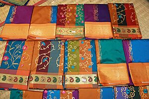
Women traditionally wear a sari, a long piece of cloth wrapped around the waist with one end draped over the shoulder. Men often wear a dhoti, a rectangular piece of unstitched cloth wrapped around the waist and legs, or a colorful lungi in rural areas. In cities, people often wear modern, Western-style clothes.
Delicious Cuisine
The food in the Deccan is diverse, with both vegetarian and non-vegetarian dishes. Eating food served on a banana leaf using the right hand is a traditional way to enjoy a meal.
- Rice is a staple food throughout the region.
- In the north and west, Bhakri (made from millets) and roti or chapathi (made from wheat) served with dal (lentil soup) are popular.
- In the east and south, breakfast often includes Idli and dosa served with sambar and chutney. For lunch, sambar and rasam are popular with rice.
- Hyderabadi cuisine is famous for its delicious biryani.
Music, Dance, and Architecture
The Deccan is home to many beautiful music and dance forms, such as Kuchipudi, Lavani, Yakshagana, and Bharatanatyam.
The region is famous for its unique rock architecture, with three main styles:
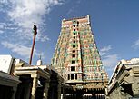
- Dravidian style: Found mostly in Tamil Nadu and Andhra Pradesh. Temples often have huge gate-pyramids called Gopurams and large pillared halls.
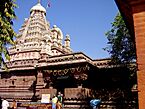
- Nagara style: Found in Maharashtra. Temples have one or more shikharas, which are tall towers over the main shrine.
- Vesara style: Found in Karnataka and Telangana. This style is a mix of both Dravidian and Nagara styles.
Getting Around: Transport in the Deccan
The Deccan Plateau has a well-developed transport system, making it easy to travel across the region.
Roads
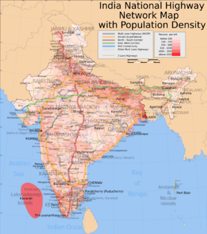
There's a huge network of roads, including National Highways (major roads connecting cities) and State Highways. The Golden Quadrilateral, a superhighway connecting India's major cities, passes through the Deccan. Public bus services are also widely available.
Railways
India's railway history is long and fascinating! The first major railway line in southern India started operating in 1856, connecting Royapuram (in Madras, now Chennai) to Arcot. Over time, many different railway companies were formed, which later merged to become Indian Railways.
Today, most of the Deccan Plateau is covered by four main railway zones:
- Southern Railway
- Western Railway
- South Central Railway
- South Western Railway
Major cities also have modern Metro and suburban train systems.
Air Travel
Air transport in the region began in the early 20th century. Today, the Deccan has many international and domestic airports. Chennai International Airport and Mumbai International Airport are two of the busiest, serving as major hubs for air travel in the southern and western parts of India, respectively.
See also
 In Spanish: Decán para niños
- Central Highlands
- Eastern Coastal Plains
- Indo-Gangetic Plain
- Western Coastal Plains
 | Frances Mary Albrier |
 | Whitney Young |
 | Muhammad Ali |


