
Arabian Sea facts for kids
Quick facts for kids Arabian Sea |
|
|---|---|
 |
|
 |
|
| Location | East Africa, West Asia and South Asia |
| Coordinates | 14°N 65°E / 14°N 65°E |
| Type | Sea |
| Part of | Indian Ocean |
| Basin countries | India Iran Maldives Oman Pakistan Seychelles Somalia Sri Lanka Yemen |
| Max. width | 2,400 km (1,500 mi) |
| Surface area | 3,862,000 km2 (1,491,000 sq mi) (3,600,000 to 4,600,000 km2 in various sources) |
| Max. depth | 4,652 m (15,262 ft) |
| Islands | Astola island, Basavaraj Durga Island, Lakshadweep, Masirah Island, Piram Island, Pirotan, Socotra |

The Arabian Sea (Arabic: بَحرُ ٱلْعَرَبْ, romanized: baḥr al-ʿarab) is a large part of the northern Indian Ocean. It is surrounded by the Arabian Peninsula to the west. To the northwest are the Gulf of Oman and Iran. Pakistan is to the north, and India is to the east. The Laccadive Sea and the Maldives are to the southeast. Finally, Somalia is to the southwest.
This huge sea covers about 3,862,000 square kilometers (1,491,000 sq mi). Its deepest point is about 4,652 meters (15,262 ft) deep. The Gulf of Aden in the west connects the Arabian Sea to the Red Sea. This connection happens through a narrow passage called the strait of Bab-el-Mandeb. The Gulf of Oman in the northwest links it to the Persian Gulf.
Contents
Geography of the Arabian Sea
The Arabian Sea covers a surface area of about 3,862,000 square kilometers (1,491,000 sq mi). It is approximately 2,400 kilometers (1,500 mi) wide at its widest point. The deepest part of the sea reaches about 4,652 meters (15,262 ft). The largest river that flows into the Arabian Sea is the Indus River.
The Arabian Sea has two important "arms" or branches. One is the Gulf of Aden in the southwest. This gulf connects to the Red Sea through the Bab-el-Mandeb strait. The other is the Gulf of Oman to the northwest. This gulf connects to the Persian Gulf. Along the Indian Coast, there are also the gulfs of Khambhat and Kutch.
Many important sea trade routes have crossed the Arabian Sea for thousands of years. Major seaports are found in several countries. In India, these include Kandla Port, Mundra Port, Mumbai Port, and Kochi Port. In Pakistan, key ports are the Port of Karachi and Gwadar Port. Other important ports are Chabahar Port in Iran and the Port of Salalah in Oman.
The largest islands in the Arabian Sea include Socotra (part of Yemen), Masirah Island (Oman), Lakshadweep (India), and Astola Island (Pakistan). The countries that have coastlines along the Arabian Sea are Yemen, Oman, Pakistan, Iran, India, and the Maldives.
Countries with Coastlines
Several countries share a border with the Arabian Sea. These include:
- India - with a coastline of about 2,500 km
- Pakistan - with a coastline of about 1,050 km
- Iran
- Maldives
- Oman
- Yemen
- Somalia
Different Names for the Sea
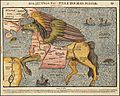
Throughout history, the Arabian Sea has been called by many different names. Both Arabian and European explorers and geographers used various names. Some of these names include the Erythraean Sea, Indian Sea, and Oman Sea. In Indian stories, it is known as Darya, Sindhu Sagar, and Arab Samudra.
Arab geographers and sailors also had their own names for this sea. They called it the Akhdar (Green) Sea, Bahre Fars (Persian Sea), the Ocean Sea, the Hindu Sea, the Makran Sea, and the Sea of Oman. Famous writers like Zakariya al-Qazwini and Al-Masudi wrote that "The green sea and Indian sea and Persian sea are all one sea." In Iran and Turkey, people often call it the Oman Sea.
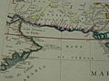
In ancient maps and writings like the Periplus of the Erythraean Sea, the Erythraean Sea referred to the entire northwestern part of the Indian Ocean, including what we now call the Arabian Sea.
Important Trade Routes

The Arabian Sea has been a very important marine trade route for a long, long time. People have used it for trade since at least 3000 BCE. Even in the time of Julius Caesar, there were well-known trade paths that combined land and sea travel. These routes used the sea to get around difficult land areas to the north.
These trade routes often started in the Far East or from rivers in Madhya Pradesh, India. Goods would be moved to ships at places like historic Bharuch. Then, they would travel past the coast of modern-day Iran. After that, the routes would split around Hadhramaut, Yemen. One path went north into the Gulf of Aden and then to the Levant. The other went south to Alexandria through Red Sea ports like Axum. Each major route involved moving goods onto camel caravans and traveling through deserts. There was always a risk of bandits and high fees from local rulers.
This southern coastal route, which went past the rough areas of the southern Arabian Peninsula, was very important. The Egyptian Pharaohs even built several shallow canals to help with this trade. One canal was somewhat like today's Suez Canal. Another went from the Red Sea to the Nile River. However, these shallow canals were eventually covered by huge sand storms long ago. Later, the kingdom of Axum in Ethiopia grew powerful by controlling trade with Europe through Alexandria.
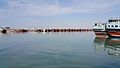
Major Ports in the Arabian Sea
Jawaharlal Nehru Port in Mumbai, India, is the largest port in the Arabian Sea. It is also the biggest container port in India. Other major Indian ports on the Arabian Sea include Mundra Port, Kandla Port, Nava Sheva, Kochi Port, Mumbai Port, and Mormugão.

The Port of Karachi in Pakistan is the country's largest and busiest seaport. It is located on the coast of the Arabian Sea, between the Karachi towns of Kiamari and Saddar.
Another important port in Pakistan is the Gwadar Port. This is a deep-sea port located in Gwadar, Balochistan. It sits at the top of the Arabian Sea and at the entrance of the Persian Gulf. It is about 460 km (290 mi) west of Karachi. The port is built on the eastern side of a natural peninsula that sticks out into the Arabian Sea.
The Port of Salalah in Salalah, Oman, is also a major port in the area. International naval forces often use this port as a base. Many warships from different countries come and go from Salalah, making it a very safe place.
Islands of the Arabian Sea

There are several islands in the Arabian Sea. The most important ones are the Lakshadweep Islands (India), Socotra (Yemen), Masirah (Oman), and Astola Island (Pakistan).
The Lakshadweep Islands are a group of islands located in the Laccadive Sea part of the Arabian Sea. They are about 200 to 440 km (120 to 270 mi) off the southwest coast of India. These islands are a union territory and are governed by the Indian government. They are the smallest union territory in India, with a total area of only 32 square kilometers (12 sq mi). Near these islands are the Maldives islands. Both the Lakshadweep and Maldives islands are part of a larger group called the Lakshadweep-Maldives-Chagos islands.
Zalzala Koh was a mud island that appeared after an earthquake in Pakistan in 2013. However, this island only lasted for a few years and disappeared by 2016.
Astola Island, also known as Jezira Haft Talar (meaning 'Island of the Seven Hills'), is a small island in Pakistan. It is uninhabited and located in the northern part of the Arabian Sea.
Socotra, also spelled Soqotra, is the largest island in the Arabian Sea. It is part of a small group of four islands. Socotra is located about 240 km (150 mi) east of the Horn of Africa. It is also about 380 km (240 mi) south of the Arabian Peninsula.
Masirah and the five Khuriya Muriya Islands are islands found off the southeastern coast of Oman.
Major Cities on the Coast
Many important cities and towns are located along the coast of the Arabian Sea. Some of the major cities include:
- Mumbai (India)
- Muscat (Oman)
- Karachi (Pakistan)
- Aden (Yemen)
- Salalah (Oman)
- Kochi (India)
- Gwadar (Pakistan)
- Dubai (UAE)
- Panaji (India)
Oxygen Minimum Zones

The Arabian Sea has one of the world's three largest "dead zones." These are areas in the ocean called oxygen minimum zones (OMZ). In these zones, the levels of oxygen are very, very low. Sometimes, standard equipment cannot even detect any oxygen. The Arabian Sea's OMZ has the lowest oxygen levels in the world, especially in the Gulf of Oman.
Why do these dead zones happen? One reason might be untreated sewage flowing into the sea. Also, high temperatures on the Indian subcontinent can increase winds that blow towards India. These winds bring up nutrients from the deep sea, which can reduce oxygen in the Arabian Sea's waters. In winter, tiny ocean plants called phytoplankton, which can live with low oxygen, make the OMZ look bright green.
Environment and Wildlife
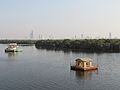
The Arabian Sea is home to a wide variety of unique animals and plants. This is because of its special location and features. The coastal areas, especially, support diverse ecosystems. For example, Mangrove forests are very common south of Karachi, Pakistan. These special trees grow in saltwater and provide homes for many creatures.

Arabian Sea Warming
Recent studies have shown that the Arabian Sea is getting warmer. Scientists believe this warming is likely due to global warming. This change in temperature can affect the sea's environment and the creatures that live there.
Native Names for the Arabian Sea
Here are some names for the Arabian Sea in the languages spoken in the countries around it:
| Language | Name | Romanized |
|---|---|---|
| Arabic | بَحرُ ٱلْعَرَبْ | baḥr al-ʿarab |
| Divehi | ޢަރަބި ކަނޑު | arabi kanḍu |
| Gujarati | અરબી સમુદ્ર | arabī samudra |
| Hindi | अरब सागर | arab sāgar |
| Tamil | அரபிகடல் | aṟabikkaḍal |
| Kannada | ಅರಬ್ಬೀ ಸಮುದ್ರ | arabbī samudra |
| Malayalam | അറബിക്കടൽ | aṟabikkaḍal |
| Marathi | अरबी समुद्र | arabī samudra |
| Persian | دریای عرب | darya-i-arab |
| Sindhi | عربي سمنڊ | arabī samaṇḍ |
| Somali | Bada Carbeed | |
| Urdu | بحیرہ عرب | bahīrā arab |
Images for kids
-
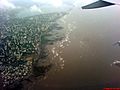
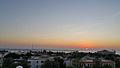
Arabian Sea above Bombay/Mumbai
-
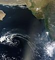
Arabian Sea seen from space
-
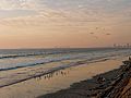
Arabian Sea in Karachi, Pakistan
-
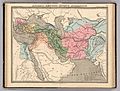
Erythraean Sea 1838.
-
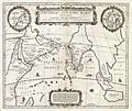
1658 Jansson Map of the Indian Ocean (Erythraean Sea)
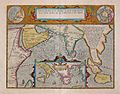
-

The western part of the Indian Ocean,1693
-
17th century map depicting the locations of the Periplus of the Erythraean Sea
-
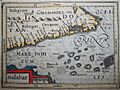
A horizontal Malabar Coast miniature, a reprint by Petrus Bertius, 1630
-
Persian Sea
-
Asia. Sinus Persicus and the Mare Persicum
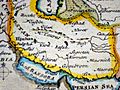
-
Iran and Makran
-
The western part of the Indian Ocean, by Vincenzo Maria Coronelli, 1693 from his system of global gores the Makran coast
-
Mangrove forests are abundant south of Karachi, Pakistan
-
Makran coast
-
Makran sea .Makoran coast in Iran
-
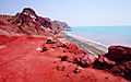
Makran coast
-

Iran


_in_Antiquity_-_Geographicus_-_ErythraeanSea-jansson-1658.jpg)


See also
 In Spanish: Mar arábigo para niños
