Panaji facts for kids
Quick facts for kids
Panaji
Panjim
|
|
|---|---|
|
Capital City
|
|
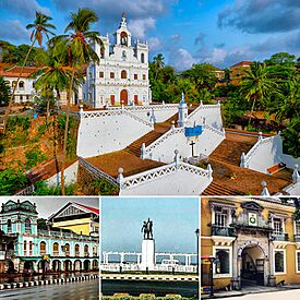
Anticlockwise from top:
|
|
| Country | |
| State | |
| District | North Goa |
| Sub-district | Tiswadi |
| Elevated to Capital | 1843 |
| Government | |
| • Type | Municipal Corporation |
| Area | |
| • City | 8.27 km2 (3.19 sq mi) |
| • Metro | 76.3 km2 (29.5 sq mi) |
| Elevation | 7 m (23 ft) |
| Population
(2011)
|
|
| • City | 40,017 |
| • Rank | 3rd in Goa |
| • Density | 4,838.8/km2 (12,532/sq mi) |
| • Metro | 114,759 |
| Demonym(s) | Ponnjekar |
| Languages | |
| • Official | |
| • Additional/Cultural |
|
| Time zone | UTC+5:30 (IST) |
| PIN |
403001
|
| Telephone code | 0832 |
| Vehicle registration | GA-01, GA-07 |
Panaji (also known as Panjim) is the capital city of the Indian state of Goa. It is also the main city of the North Goa district. Before, it was the capital of Portuguese India.
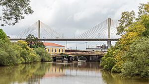
Panaji is located on the banks of the Mandovi river. It is the largest city area in Goa, with over 114,000 people. The city has hills, buildings with red roofs, churches, and a riverwalk. You can see beautiful gulmohar and acacia trees. The famous Our Lady of the Immaculate Conception Church stands over the main square. Panaji is also becoming a "smart city" as part of a special Indian government plan.
The city was planned with stepped streets and a long river promenade. This happened after the Portuguese moved their capital here in the 17th century. Panaji officially became a city on March 22, 1843.
Contents
What's in a Name?
The city's official name changed from Panjim to Panaji in the 1980s. The Portuguese name for the city is Pangim. It was also called Nova Goa (New Goa) when it became the capital of Portuguese India.
The name Panaji comes from old words. Panjani means 'a boat' and khali means 'a small creek' in Sanskrit. So, Panjim might come from Panjanakhani. This name was found on old copper plates from 1059 CE.
Panaji's Past
Panaji became the capital of Portuguese India because of a terrible sickness. This sickness greatly reduced the population of the old capital, City of Goa, in the mid-1700s.
In 1961, India took over Goa and other Portuguese areas. Panaji then became the capital of the Union Territory of Goa, Daman and Diu. In 1987, Goa became a state, and Panaji became its state capital. Today, Panaji is also the main office for the North Goa district.
City Layout
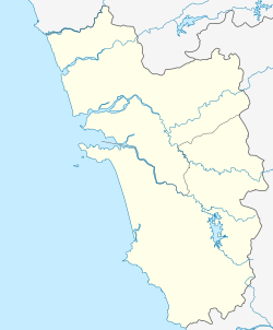
Panaji is located at 15°29′56″N 73°49′40″E / 15.49889°N 73.82778°E. It is about 7 meters (23 feet) above sea level.
City Areas
Panaji has many smaller areas or neighborhoods. Some of these include:
- São Tomé
- Fontainhas
- Mala
- Altinho
- Campal
- Santa Inez
- Dona Paula
- Platô de Taleigão
The city is on the Mandovi River. It also has two creeks, which locals call pői. These are Ourém creek and Santa Inêz creek.
People of Panaji
In 2011, Panaji had a population of 114,405 people. About 52% were male and 48% were female. Most people in Panaji can read and write, with a literacy rate of 90.9%.
Religions
Panaji is home to people of different religions. The largest group is Hinduism, with about 64% of the people. Christianity is the second largest, with about 26.5% followers. Islam makes up about 8.8% of the population. Other religions like Buddhism, Jainism, and Sikhism are also present.
Panaji's Weather
Panaji has a tropical monsoon climate. This means it's hot in summer and mild in winter.
- During summer (March to May), temperatures can reach up to 32°C (90°F).
- In winter (November to February), temperatures are usually between 23°C (73°F) and 31°C (88°F).
The monsoon season is from June to October. During this time, there is heavy rainfall and strong winds. The city gets about 2932 mm (115 inches) of rain each year.
| Climate data for Panaji (1991–2020, extremes 1901–2012) | |||||||||||||
|---|---|---|---|---|---|---|---|---|---|---|---|---|---|
| Month | Jan | Feb | Mar | Apr | May | Jun | Jul | Aug | Sep | Oct | Nov | Dec | Year |
| Record high °C (°F) | 36.7 (98.1) |
39.2 (102.6) |
39.0 (102.2) |
39.8 (103.6) |
38.6 (101.5) |
37.8 (100.0) |
33.5 (92.3) |
34.0 (93.2) |
33.4 (92.1) |
37.2 (99.0) |
37.2 (99.0) |
36.6 (97.9) |
39.8 (103.6) |
| Mean daily maximum °C (°F) | 32.5 (90.5) |
32.4 (90.3) |
32.6 (90.7) |
33.4 (92.1) |
33.8 (92.8) |
30.9 (87.6) |
29.3 (84.7) |
29.5 (85.1) |
30.2 (86.4) |
32.0 (89.6) |
33.5 (92.3) |
33.1 (91.6) |
32.0 (89.6) |
| Daily mean °C (°F) | 26.3 (79.3) |
26.4 (79.5) |
27.7 (81.9) |
29.3 (84.7) |
30.1 (86.2) |
27.8 (82.0) |
26.8 (80.2) |
26.7 (80.1) |
27.0 (80.6) |
27.8 (82.0) |
27.9 (82.2) |
26.9 (80.4) |
27.6 (81.6) |
| Mean daily minimum °C (°F) | 20.0 (68.0) |
20.6 (69.1) |
23.3 (73.9) |
25.4 (77.7) |
26.3 (79.3) |
24.9 (76.8) |
24.2 (75.6) |
24.2 (75.6) |
24.0 (75.2) |
24.0 (75.2) |
22.7 (72.9) |
20.9 (69.6) |
23.4 (74.1) |
| Record low °C (°F) | 14.4 (57.9) |
13.3 (55.9) |
16.8 (62.2) |
20.2 (68.4) |
20.9 (69.6) |
20.7 (69.3) |
21.6 (70.9) |
21.7 (71.1) |
21.0 (69.8) |
20.0 (68.0) |
15.3 (59.5) |
15.7 (60.3) |
13.3 (55.9) |
| Average rainfall mm (inches) | 1.0 (0.04) |
0.1 (0.00) |
0.0 (0.0) |
4.9 (0.19) |
76.6 (3.02) |
890.4 (35.06) |
955.2 (37.61) |
571.7 (22.51) |
304.1 (11.97) |
156.4 (6.16) |
21.3 (0.84) |
2.5 (0.10) |
2,984.1 (117.48) |
| Average rainy days | 0.1 | 0.0 | 0.1 | 0.3 | 3.6 | 21.2 | 26.7 | 23.0 | 13.7 | 6.8 | 1.5 | 0.2 | 97.3 |
| Average relative humidity (%) (at 17:30 IST) | 57 | 59 | 65 | 67 | 69 | 83 | 87 | 86 | 82 | 76 | 65 | 58 | 71 |
| Mean monthly sunshine hours | 303.8 | 291.0 | 288.3 | 279.0 | 285.2 | 132.0 | 96.1 | 120.9 | 180.0 | 232.5 | 270.0 | 294.5 | 2,773.3 |
| Mean daily sunshine hours | 9.8 | 10.3 | 9.3 | 9.3 | 9.2 | 4.4 | 3.1 | 3.9 | 6.0 | 7.5 | 9.0 | 9.5 | 7.6 |
| Source 1: India Meteorological Department (sun, 1971–2000) | |||||||||||||
| Source 2: Tokyo Climate Center (mean temperatures 1981–2010) | |||||||||||||
Exploring Panaji
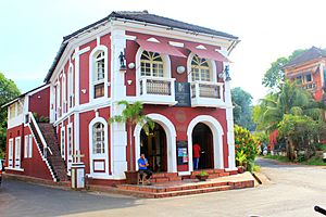
The main part of Panaji is the Praça da Igreja (Church Square). Here you'll find the beautiful Our Lady of the Immaculate Conception Church. It was first built in 1541.
Other interesting places include:
- The old Adilshahi Palace, now known as the Old Secretariat.
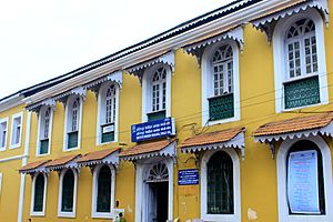
- The Institute Menezes Braganza.
- The Chapel of St. Sebastian.
- The Fontainhas area, which is like an old Latin Quarter.
- The nearby Miramar beach.
The Mahalaxmi Temple is also a very important place in Panaji. People from all backgrounds visit this temple.
Panaji celebrates the carnival in February with a colorful parade. This is followed by the Shigmo or Holi festival. The Narkāsūr parade the night before Diwali is also very vibrant.
Popular spots in Panaji include:
- 18th June Road: A busy street for shopping.
- Miramar beach.
- The Kala Academy: A cultural center known for its unique building. It showcases Goan art and culture.
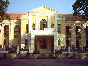
Old Secretariat Building
The 'Old Secretariat' building, also called 'Adil Shah's Palace', is on the banks of the Mandovi River. It was built around 1500 by Yusuf Adil Shah as a summer home and fort. The Portuguese later used it as a temporary home for their first Viceroy. Today, this old building is 'The Goa State Museum'.
More Attractions
The Salim Ali Bird Sanctuary is a great place for bird lovers. It's named after a famous bird expert, Dr. Salim Ali. This sanctuary is home to many rare and endangered birds.
Goa is famous for its beaches. Miramar, Bambolim, and Dona Paula are popular beaches near Panaji.
Dona Paula is where the Zuari and Mandovi rivers meet the Arabian Sea. The Governor of Goa lives at Cabo Raj Bhavan, located at Dona Paula.
The Goa Science Centre opened in 2001 and is a fun place to learn. Panaji is also known as the "Casino capital" of India.
Learning in Panaji
Goa's main university, the Goa University, is just outside Panaji in Taleigão. Some other important schools and colleges in Panaji are:
- Don Bosco College, Panjim
- Goa Medical College, Bambolim
- Goa College of Pharmacy
- Goa Polytechnic Panaji
- Don Bosco High School
- Goa Institute of Management
- Sharada Mandir School, Miramar
Research Centers
The National Institute of Oceanography (CSIR-NIO) is located in Dona Paula. This center focuses on research about the ocean.
Getting Around Panaji
The closest airport is Dabolim Airport, about 30 km (19 miles) away. Another new airport, Mopa Airport, is about 40 km (25 miles) away. Buses are the main way to travel around the city.
Media and Communication
All India Radio has a local station in Panaji. It broadcasts many programs for the public. The yearly International Film Festival of India (IFFI) is also held in Panaji.
How Panaji is Governed
Many important government offices are located in Panaji. These include offices for both the Goa government and the Indian government.
- Bombay High Court – Goa bench
- Goa Passport Office
- Sports Authority of Goa
- All India Radio, Altinho
- Doordarshan Complex, Altinho
The Goa Legislative Assembly (where laws are made) is in Alto Porvorim, about 2 km (1.2 miles) from Panaji. The Altinho hill has many central government offices and homes for important officials.
Sports in Panaji
Panaji is home to two major football clubs: Dempo S.C. and Sporting Clube de Goa. They play in India's top football league, the I-League. The Clube Tennis de Gaspar Dias, founded in 1926, is a popular tennis club. There is also a football club called FC Goa in the Indian Super League.
Sister Cities
Panaji has special connections with other cities around the world. These are called "twin towns" or "sister cities."
See also
 In Spanish: Panaji para niños
 | Aurelia Browder |
 | Nannie Helen Burroughs |
 | Michelle Alexander |


