Western Ghats facts for kids
Quick facts for kids Western Ghats |
|
|---|---|
| Pashchima Ghats | |
|
|
| Highest point | |
| Peak | Anamudi (Eravikulam National Park) |
| Elevation | 2,695 m (8,842 ft) |
| Dimensions | |
| Length | 1,600 km (990 mi) N–S |
| Width | 100 km (62 mi) E–W |
| Area | 160,000 km2 (62,000 sq mi) |
| Geography | |
| Country | India |
| Settlements |
List
Nashik Pune Sirsi Shivamogga Sakleshpura Madikeri Iritty Mananthavady Sulthan Bathery Sathyamangalam Ooty Nilambur Coimbatore Palakkad Pollachi Munnar Pala Pathanamthitta Punalur Tenkasi Nedumangad |
| Biome | Tropical rainforests and Marshe |
| Geology | |
| Age of rock | Cenozoic |
| Type of rock | Basalt, Laterite and Limestone |
| UNESCO World Heritage Site | |
| Criteria | Natural: ix, x |
| Inscription | 2012 (36th Session) |
| Area | 795,315 ha |
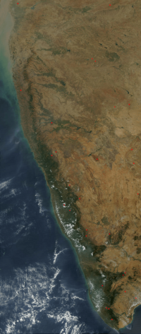
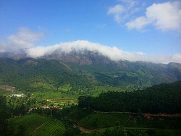
The Western Ghats, also known as the Sahyadri mountain range, is a long mountain chain in India. It stretches for about 1,600 kilometers (1,000 miles) along the western coast of the Indian peninsula. This mountain range covers an area of 160,000 square kilometers (62,000 square miles).
It passes through several states like Gujarat, Maharashtra, Goa, Karnataka, Kerala, and Tamil Nadu. The Western Ghats are a UNESCO World Heritage Site. They are also one of the 36 "biodiversity hotspots" in the world. This means they have a huge variety of plants and animals, many of which are found nowhere else.
These mountains are older than the Himalayas. They play a big role in India's weather, especially the monsoon rains. They block the rain-filled winds coming from the southwest in late summer. This causes heavy rainfall on their western side. The range runs north to south, separating the Deccan Plateau from a narrow coastal plain along the Arabian Sea. In 2012, 39 areas within the Western Ghats were named World Heritage Sites. These include national parks, wildlife sanctuaries, and reserve forests.
The range begins south of the Tapti river and goes all the way to Marunthuvazh Malai near the southern tip of India. These hills collect water for many river systems. These rivers drain almost 40% of India's land. The Western Ghats stop the southwest monsoon winds from reaching the Deccan Plateau. The mountains are about 1,200 meters (3,900 feet) high on average.
This area is one of the world's top ten "hottest biodiversity hotspots." It is home to over 7,400 types of flowering plants and 1,800 types of non-flowering plants. It also has 139 mammal species, 508 bird species, and 227 reptile species. You can find 179 amphibian species, 290 freshwater fish species, and 6,000 insect species here. Many new species are likely still waiting to be discovered. At least 325 species found here are considered threatened species globally.
Contents
What's in a Name?
The word "Ghat" comes from several Dravidian languages. For example, in Kannada, gaati and ghatta mean "mountain range." In Tamil, gattu means "hill and hill forest."
In India, "Ghat" can mean a range of stepped hills, like the Western Ghats. It can also mean steps leading down to water, like bathing places along a river. Roads that go through these mountain passes are called Ghat Roads.
How the Mountains Formed
The Western Ghats are the edge of the Deccan Plateau. They were formed when the supercontinent Gondwana broke apart about 150 million years ago. Scientists believe India's west coast formed around 100 to 80 million years ago. This happened after India separated from Madagascar.
After this break-up, the western coast of India would have looked like a steep cliff. It was about 1,000 meters (3,300 feet) high. The main rock found here is Basalt, which can be up to 3 kilometers (1.9 miles) thick. Other rocks include granite and limestone. You can also find laterite and bauxite ores in the southern hills.
Where are the Western Ghats?
The Western Ghats start near the Satpura Range in the north. They stretch from Gujarat all the way to Tamil Nadu in the south. They pass through Maharashtra, Goa, Karnataka, and Kerala.
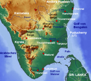
There are some major gaps in the mountain range. The Goa Gap is between the Maharashtra and Karnataka parts. The Palghat Gap is on the border of Tamil Nadu and Kerala. This gap is between the Nilgiri Mountains and the Anaimalai Hills.
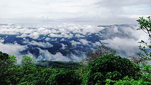
These mountains block the rain-carrying westerly monsoon winds. This makes the western side of the Ghats very rainy. The thick forests also help create rain. They act like a sponge, collecting moisture from the air. Then, they release it back through transpiration, which later falls as rain.
The narrow coastal plain between the Western Ghats and the Arabian Sea has different names. The northern part is the Konkan. The middle part is Kanara, and the southern part is the Malabar. East of the Ghats, the foothills in Maharashtra are called Desh. In central Karnataka, they are known as Malenadu.
The range is called Sahyadri in Maharashtra and Karnataka. The Western Ghats meet the Eastern Ghats at the Nilgiri mountains in northwestern Tamil Nadu. South of the Palghat Gap are the Anamala Hills. These are in western Tamil Nadu and Kerala. Further south are smaller ranges like the Cardamom Hills.
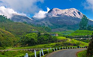
The highest peak in the Western Ghats is Anamudi, standing at 2,695 meters (8,842 feet). Ooty is a famous hill station often called the "Queen of the Western Ghats."
Mountain Peaks
The Western Ghats have many peaks over 2,000 meters (6,600 feet) high. Anamudi is the tallest among them.
Rivers and Waterfalls
The Western Ghats are one of India's main watersheds. Many important rivers start here. These include the Godavari, Kaveri, Krishna, and Tungabhadra rivers. Most streams in the Western Ghats join these rivers. They carry a lot of water during the monsoon season. These rivers flow east into the Bay of Bengal.
Some rivers, like the Periyar and Sharavathi, flow west into the Arabian Sea. These rivers move fast because the land slopes steeply. Many of these rivers have been dammed to create hydroelectric power and for irrigation. The Western Ghats produce 80% of India's hydropower.
There are about 50 major dams in the Western Ghats. Famous ones include Koyna in Maharashtra and Idukki in Kerala. During the monsoon, many streams create beautiful waterfalls. Some well-known waterfalls are Dudhsagar, Jog, and Athirappilly.
Talakaveri is where the Kaveri river begins. The Kuduremukha range is the source of the Tungabhadra river. The Western Ghats also have several man-made lakes and reservoirs.
Climate and Weather
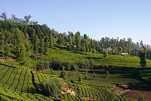
Some areas in the Western Ghats, like Agumbe in Karnataka, get a lot of rain. They are sometimes called the "Cherrapunji of southwest India." Kollur and Neriamangalam are also among the wettest places. The continuous mountains without many gaps cause heavy rain in nearby regions.
The climate in the Western Ghats changes with height and distance from the equator. Lower areas are humid and tropical, influenced by the sea. Higher areas, above 1,500 meters (4,900 feet) in the north and 2,000 meters (6,600 feet) in the south, have a cooler climate. The average yearly temperature is about 15°C (59°F). In some parts, it can freeze in winter.
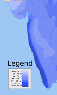
During the monsoon season (June to September), the Western Ghats act as a wall against moisture-filled clouds. These clouds are forced to rise and drop most of their rain on the western side. Rainfall here averages 300 to 400 cm (120 to 160 inches). Some places get as much as 900 cm (350 inches)! The eastern regions, which are in the rain shadow, get much less rain, about 100 cm (39 inches).
Rainfall in the Ghats
The Karnataka region of the Western Ghats generally gets more rain than Kerala, Maharashtra, and Goa. This is because the Ghats in Karnataka have fewer passes. The western slopes of Karnataka receive over 400 cm (160 inches) more rainfall than other parts of the Western Ghats.
Some of the wettest places in the Western Ghats include:
- Agumbe, Karnataka: 7624 mm (300 in)
- Amboli, Maharashtra: 7000 mm (276 in)
- Hulikal, Karnataka: 5316 mm (209 in)
- Mahabaleshwar, Maharashtra: 5761 mm (227 in)
- Dhamanohol, Maharashtra: 6255 mm (246 in)
Different Forest Types
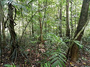
The Western Ghats are home to four types of tropical and subtropical moist broadleaf forests. These are called "ecoregions." The northern part is usually drier. At lower heights, you find the North Western Ghats moist deciduous forests, with many teak trees. Above 1,000 meters (3,300 feet), it's cooler and wetter. Here, you find evergreen forests with trees from the Lauraceae family.
The evergreen forests in Wayanad are a transition zone between the northern and southern parts. The southern ecoregions are generally wetter and have more species. At lower heights, there are South Western Ghats moist deciduous forests. Above 1,000 meters (3,300 feet), you find the South Western Ghats montane rain forests. These are cooler and wetter, with evergreen trees. They also have some montane grasslands at the highest points.
The South Western Ghats montane rain forests are the richest in species in peninsular India. Eighty percent of all the flowering plant species in the Western Ghats are found here.
Protecting Nature
Long ago, the Western Ghats were covered in thick forests. These forests provided food and homes for local tribes. It was hard for people from the plains to farm or build here. But after the British colonial rule, large areas were cleared for farms and timber. The forests have been broken up a lot by human activities. This includes cutting down trees for tea, coffee, and teak plantations from 1860 to 1950. Rare and unique species are affected the most and disappear faster.
The area is very sensitive to development. In 1988, it was named an ecological hotspot. This means it's a place with many unique species that are also at risk. The Western Ghats cover only five percent of India's land. Yet, 27% of all higher plant species in India are found here. About 1,800 of these are found only in this region. The range is also home to at least 84 amphibian species, 16 bird species, and seven mammals found nowhere else.
The Government of India has set up many protected areas. These include 2 biosphere reserves and 13 national parks. There are also many wildlife sanctuaries to protect endangered species. These areas are managed by state forest departments to save the undeveloped ecoregions.
The Nilgiri Biosphere Reserve is the largest protected area in the Western Ghats. It covers 5,500 square kilometers (2,100 square miles). It includes forests in Karnataka, Kerala, and Tamil Nadu. Silent Valley National Park in Kerala is one of the last untouched tropical evergreen forests in India.
In 2011, a group of experts called the Western Ghats Ecology Expert Panel said the entire Western Ghats should be an Ecologically Sensitive Area. They suggested different levels of protection for different parts. In 2012, UNESCO officially declared many places in the Western Ghats as World Heritage Sites.
Some of these World Heritage Sites include:
- Kali Tiger Reserve, Karnataka
- Indira Gandhi Wildlife Sanctuary and National Park, Tamil Nadu
- Kalakkad Mundanthurai Tiger Reserve, Tamil Nadu
- Periyar Tiger Reserve, Kerala
- Eravikulam National Park, Kerala
- Silent Valley National Park, Kerala
- Mukurthi National Park, Tamil Nadu
- Kudremukh National Park, Karnataka
- Kaas Plateau, Maharashtra
- Chandoli National Park, Maharashtra
- Bandipur National Park , Karnataka
- Nagarhole National Park, Karnataka
- Mudumalai National Park, Tamil Nadu
Animals of the Western Ghats
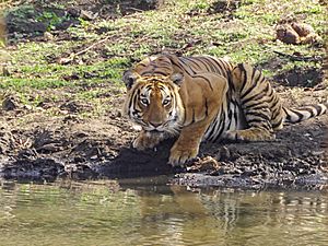
The Western Ghats are home to thousands of animal species. At least 325 of these are globally threatened species.
Mammals
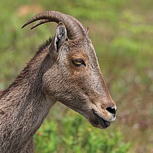
There are at least 139 types of mammals here. Of the 16 mammals found only here, 13 are threatened. Some of the 32 threatened species include the tiger, leopard, lion-tailed macaque, Nilgiri tahr, and Asian elephant. The Malabar large-spotted civet is very rare, with fewer than 250 adults left.
The Western Ghats are important for Project Elephant and Project Tiger reserves. The largest tiger population in India lives here, with about 1,200 tigers. The Western Ghats also have the largest wild Indian elephant population, estimated at 11,000 elephants. The Nilgiri tahr, a type of goat, was almost extinct but has recovered. There are now about 3,122 of them.
Reptiles
At least 227 species of reptiles live in the Western Ghats. Many unique types of snakes and lizards are found only here. Some rare reptiles include venomous snakes like the Malabar pit viper. The region also has a good number of mugger crocodiles.
Amphibians
The amphibians of the Western Ghats are very special. More than 80% of the 179 amphibian species are found only in these mountains' rainforests. The purple frog was discovered in 2003. Many new frog species have been found here recently.
The region also has many caecilian species. These are worm-like amphibians. Sadly, Deforestation is a big threat to these amphibians.
Fish
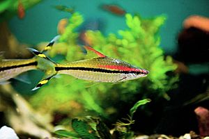
As of 2004, 288 freshwater fish species were found in the Western Ghats. Many new species have been discovered since then. There are 118 species found only here. The southern part of the Western Ghats has more fish species than the northern part. The Chalakudy River alone has 98 species.
The most common fish families are Cyprinids (like carps) and hillstream loaches. The region is home to beautiful ornamental fish like the Denison barb and zebra loach. Some fish here are adapted to live underground, like certain swampeels and catfishes.
In 2011, 97 freshwater fish species from the Western Ghats were considered threatened. This includes 12 critically endangered species. The main threats are habitat loss, too much fishing, and introduced species.
Birds
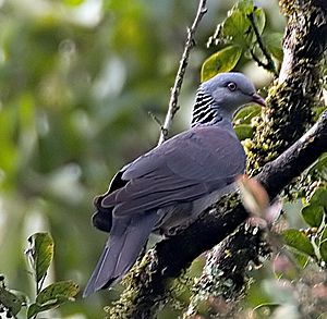
There are at least 508 bird species in the Western Ghats. Many of Karnataka's birds live in this region. At least 16 bird species are found only in the Western Ghats. These include the endangered rufous-breasted laughingthrush and the Nilgiri wood-pigeon. Other unique birds are the Malabar grey hornbill and the crimson-backed sunbird.
Insects
There are about 6,000 insect species here. Of 334 types of butterflies in the Western Ghats, 316 have been seen in the Nilgiri Biosphere Reserve. The Western Ghats are also home to 174 species of odonates (dragonflies and damselflies). Many of these are found only here.
Mollusks
The Western Ghats have a high number and variety of land snails. There are at least 258 species of gastropods (snails) here. Also, 77 species of freshwater molluscs have been recorded. This includes 28 species found only in this region. Some threatened freshwater mollusks include the mussels Pseudomulleria dalyi.
Plants of the Western Ghats
The main type of forest here is tropical rainforest. You can also find Montane forests, tropical dry forests, and tropical moist forests. Out of 7,402 flowering plant species in the Western Ghats, 5,588 are native. About 1,273 species are found only in the Western Ghats.
Many plant species are unique to the Western Ghats. This includes the palm tree Bentinckia condapanna and the flower Strobilanthes kunthiana. Some plant species are also Critically Endangered, like Dipterocarpus bourdillonii.
Dangers to the Western Ghats
The Western Ghats face many problems. These include Poaching, deforestation, forest fires, and dangers to local tribes. Even though poaching was banned in India in 1972, people still illegally hunt animals like tigers and elephants. They are hunted for their skin, fur, or tusks.
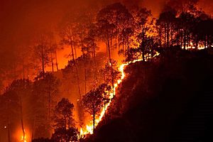
Forests are being destroyed for farming and raising livestock. Animals that eat livestock are sometimes killed by farmers. Forest fires happen every year during the dry summer season. These fires especially affect areas like the Nagarhole-Bandipur-Wayanad block. This area has the most diverse life in the Western Ghats and the largest populations of tigers and elephants.
Native tribes are being forced out of their homes. This harms their culture. The rich variety of plants and animals in the Western Ghats makes it a target for companies wanting resources. However, the Government of India and state governments are working to protect the Western Ghats.
See also
 In Spanish: Ghats occidentales para niños
- Ghat Roads
- Eastern Ghats
 | Victor J. Glover |
 | Yvonne Cagle |
 | Jeanette Epps |
 | Bernard A. Harris Jr. |


