
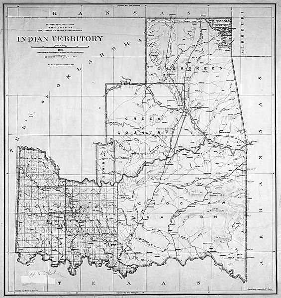
Image: IndianTerritory

Size of this preview: 565 × 599 pixels. Other resolutions: 226 × 240 pixels | 1,000 × 1,061 pixels.
Original image (1,000 × 1,061 pixels, file size: 233 KB, MIME type: image/jpeg)
Description: Map of Indian territory in Oklahoma in 1891.
Title: IndianTerritory
Credit: National Archives Federal Indian Policy, direct image here. Original upload from http://www.archives.gov/digital_classroom/lessons/federal_indian_policy/federal_indian_policy.html Source claims the image is available in ARC with identifier NWDC-49-STP-IT1885 (or possibly NWDC-49-STP-IT1891), but cannot find it.
Author: General Land Office, U.S. Department of the Interior
Usage Terms: Public domain
License: Public domain
Attribution Required?: No
Image usage
The following 3 pages link to this image:

All content from Kiddle encyclopedia articles (including the article images and facts) can be freely used under Attribution-ShareAlike license, unless stated otherwise.