
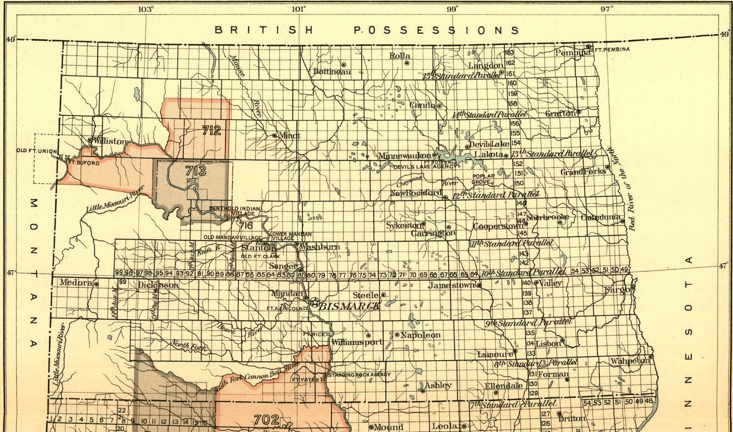
Image: Indian territories, North Dakota. Map 3 (1880-1892)
Size of this preview: 800 × 472 pixels. Other resolutions: 320 × 189 pixels | 1,437 × 847 pixels.
Original image (1,437 × 847 pixels, file size: 2.64 MB, MIME type: image/png)
Description: Indian territories, North Dakota. Map 3
Title: Indian territories, North Dakota. Map 3 (1880-1892)
Credit: 18th Annual Report of the Bureau of American Ethnology, part 2, 1896-'97. Smithsonian Institution.
Author: G.P.O. 1899
Usage Terms: Public domain
License: Public domain
Attribution Required?: No
Image usage
The following page links to this image:

All content from Kiddle encyclopedia articles (including the article images and facts) can be freely used under Attribution-ShareAlike license, unless stated otherwise.
.png)