
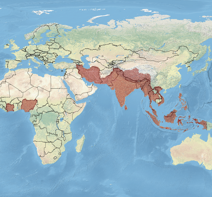
Image: Indoplanorbis exustus map
Size of this preview: 645 × 599 pixels. Other resolutions: 258 × 240 pixels | 901 × 837 pixels.
Original image (901 × 837 pixels, file size: 544 KB, MIME type: image/png)
Description: Distribution map of Indoplanorbis exustus.
Title: Indoplanorbis exustus map
Credit: This PNG graphic was created with QGIS.
Author: Michal Maňas Natural Earth. IUCN Red List of Threatened Species, species assessors and the authors of the spatial data.
Usage Terms: Creative Commons Attribution-Share Alike 3.0
License: CC BY-SA 3.0
License Link: https://creativecommons.org/licenses/by-sa/3.0
Attribution Required?: Yes
Image usage
The following page links to this image:

All content from Kiddle encyclopedia articles (including the article images and facts) can be freely used under Attribution-ShareAlike license, unless stated otherwise.